On a Philippine island, indigenous groups take the fight to big palm oil

Palm oil tramples indigenous people's rights.

  • Many Palawan indigenous communities say they have suffered unfair land acquisition or lease arrangements for oil palm plantations. The situation hit a peak around 2007, when palm oil company Agumil Philippines promoted palm oil around the island as a miracle get-rich-quick crop.
  • Many tribal landowners leased or sold parcels of land to Agumil. Those who leased said they were provided loans from the government-run Land Bank of the Philippines, negotiated by Agumil, to clear the land and plant oil palm saplings. Title deeds to the leased land were lodged with the bank as collateral against the loans, where they remain.
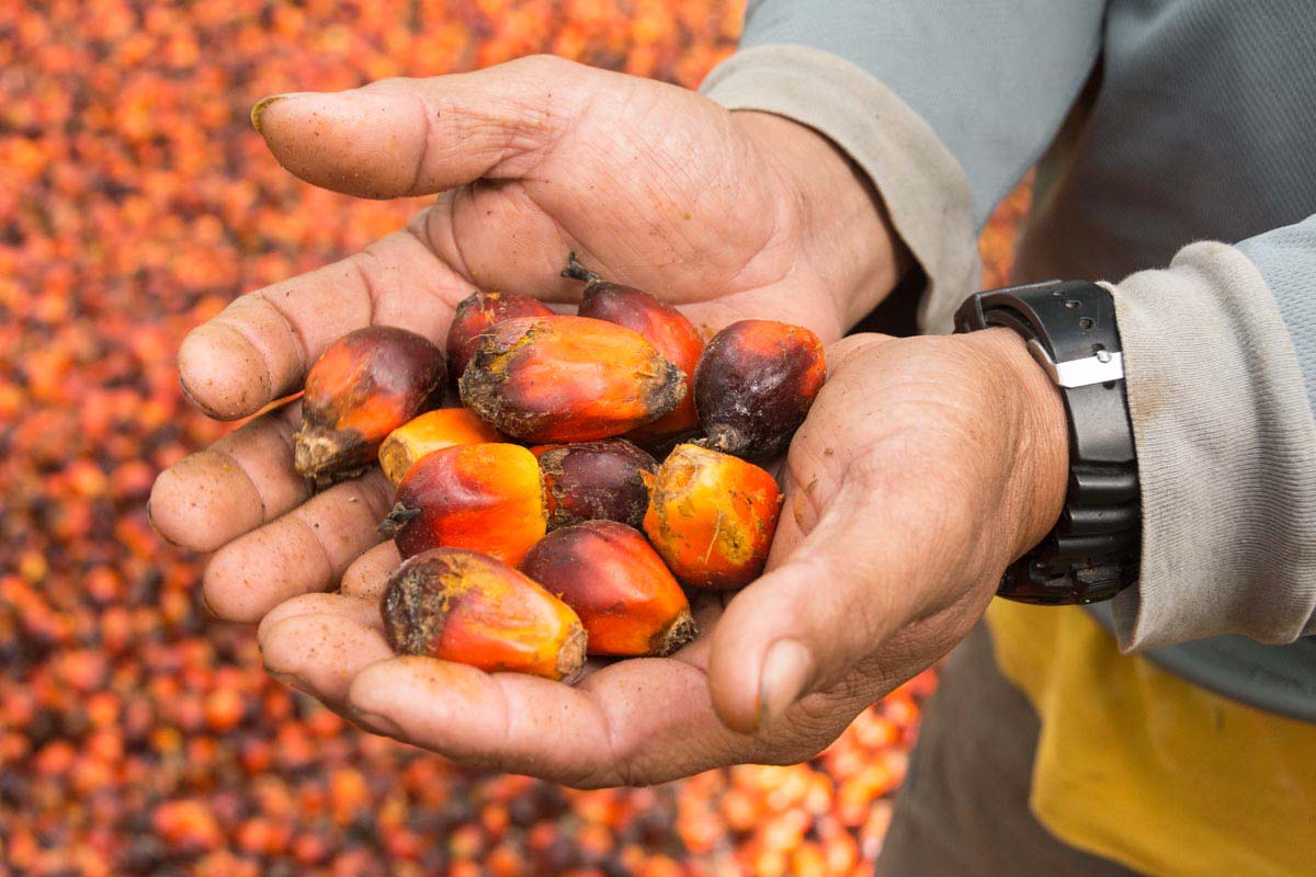
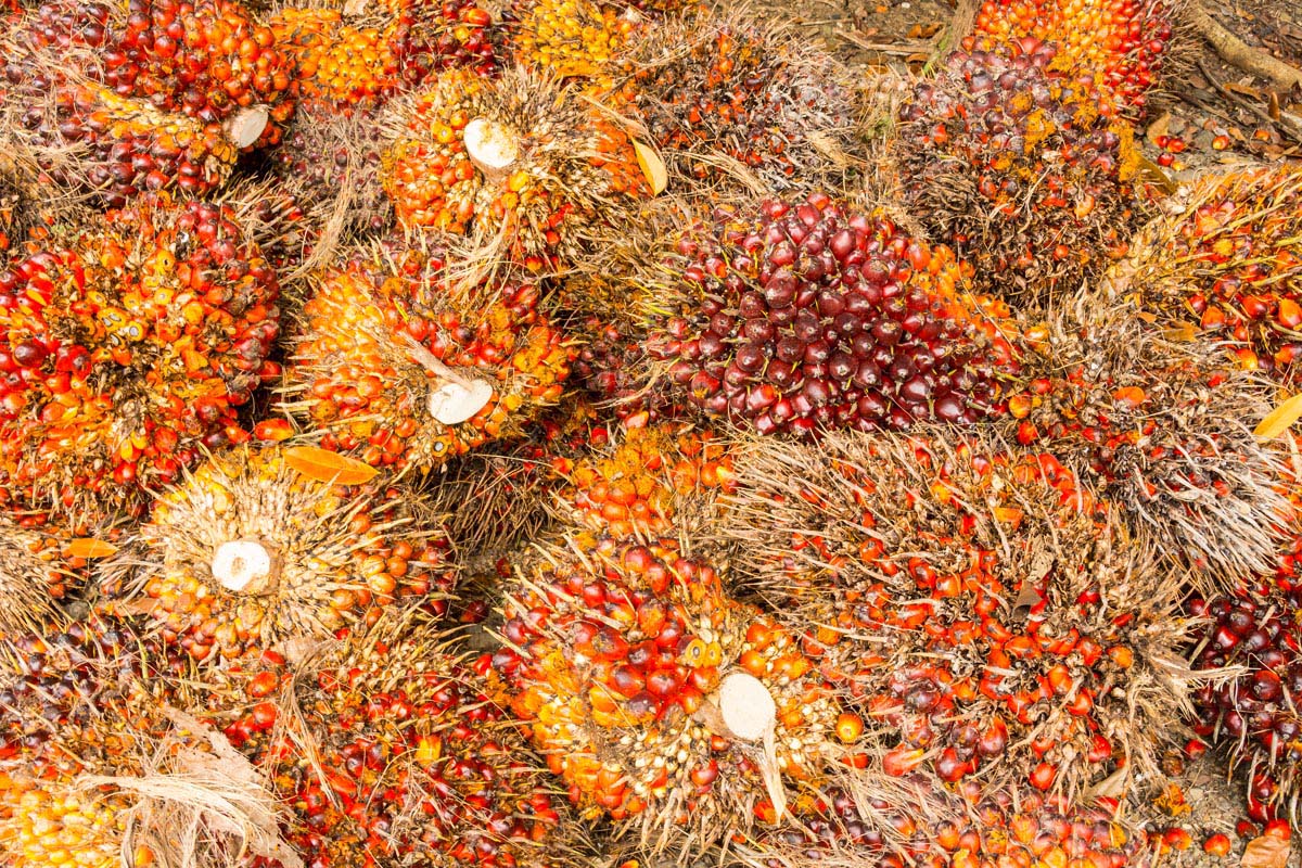
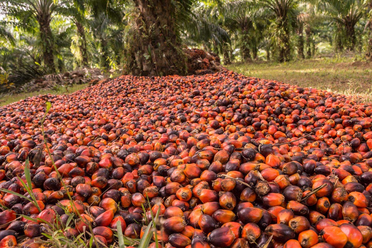
  • Today the plantations are producing plentiful bunches of oil palm fruit. Still, landowners say they have yet to see any financial returns on their leased land. The problem all cite is that the loans came with crippling 14 percent annual interest rates, which left the original loan amounts inflating out of control. The terms of the lease contracts also stipulate that ongoing operational and managements costs be subtracted from the loan and harvest income.
  • Now tribal groups are fighting back on multiple fronts. A tribal representative in the municipality of Rizal recently won a mayoral election. The re-elected mayor of neighboring Brooke’s Point has also pledged a halt to more oil palm plantations. Three of the seven municipalities in southern Palawan have now placed limitations on oil palm cultivation.

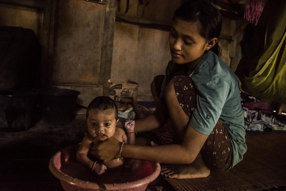
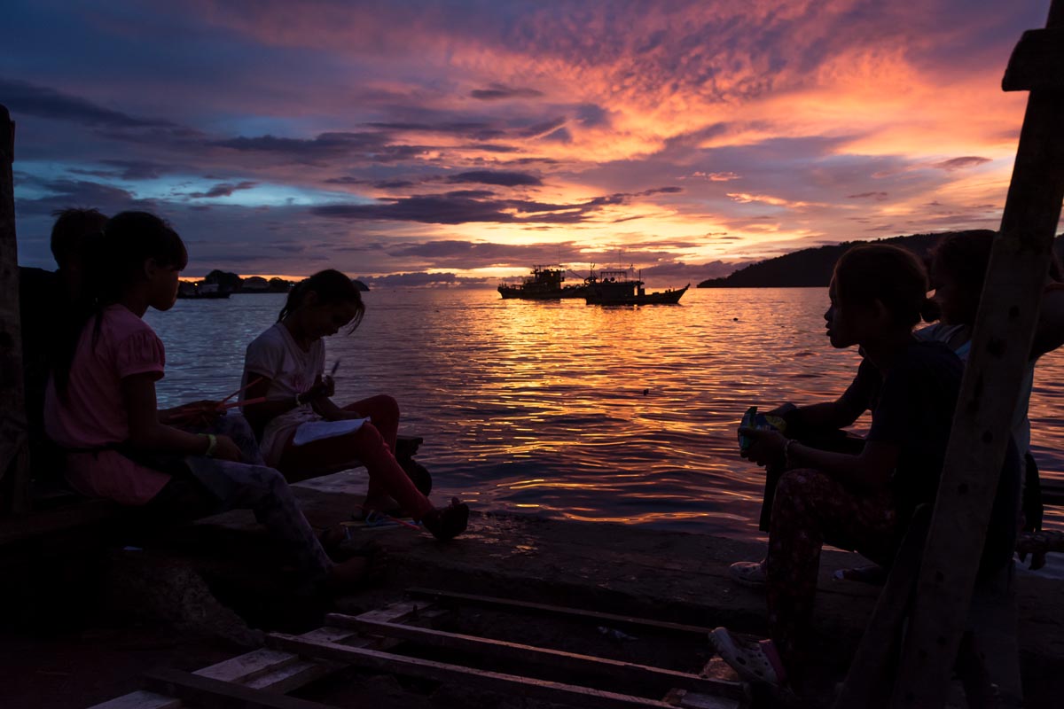
The sandy path from the village of bamboo houses winds down through the coconut palms, which gives way to mangroves growing along the muddy shoreline. The seven elders inspect their fishing boats. Hand-built using timber from their communal forest, the small craft have bamboo outriggers to keep them stable in the open sea.

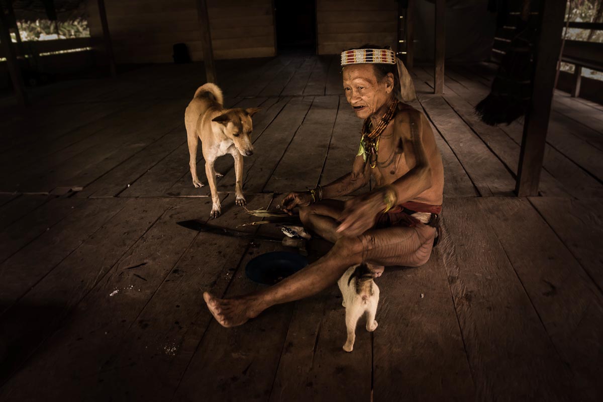
The Sarong community on the island of Palawan in the Philippines has for generations been living a similar way of life from the forest, cultivated fields, stands of coconut and fishing. But a few years ago, in 2012, their lives were turned upside down when they noticed that their communal forest was being logged and cleared without any consultation, let alone their permission.

“A contractor coming from another barangay [village] was clearing the land,” says Romeo L. Japson, who grew up in the community.

Community members say the company responsible then went on to plant oil palm saplings on 200 hectares (500 acres) of their ancestral land. They add that now, every time they pass by the plantation, they’re reminded of how their community forest was razed. To this day they are bitter that the situation persists and they have no redress.

They are not alone, as many other Palawan indigenous communities have also suffered what they see as unfair land acquisition or lease arrangements for oil palm plantations. The situation hit a peak around 2007, when palm oil company Agumil Philippines promoted palm oil around the island as a miracle get-rich-quick crop. Twenty-five percent Filipino- and 75 percent Malaysian-owned, Agumil is a subsidiary of Agusan Plantations (API) and operates the only palm oil processing plant on Palawan.

Now tribal groups are fighting back on multiple fronts. A tribal representative in the municipality of Rizal recently won a mayoral election. The re-elected mayor of neighboring Brooke’s Point has also pledged a halt to more oil palm plantations. Three of the seven municipalities in southern Palawan have now placed limitations on oil palm cultivation.

Meanwhile, a growing number of communities are responding to threats to their ancestral domains by pursuing legal recognition of their community land and water resources. Two communities celebrated success in 2018, and at least 12 more claims are in process.

Tribal land appropriation

Many tribal landowners leased or sold parcels of land to Agumil. Those who leased said they were provided loans from the government-run Land Bank of the Philippines, negotiated by Agumil, to clear the land and plant oil palm saplings. Title deeds to the leased land were lodged with the bank as collateral against the loans, where they remain.

“Until now I am riding only in my thongs,” said Mily Saya, landowner and member of the village cooperative in the barangay of Aramaywan. He explains how early company promises of a car and stone house failed to materialize. He says he “has no idea how to get back the land title” for his 4.7 hectares (11.6 acres) from the Land Bank.

“I don’t know how big the loan is from the Land Bank,” he says, explaining how the company planted oil palm seedlings on 1 hectare (2.5 acres) of his land but abandoned the rest with no explanation.

In time, the saplings matured and today the plantations are producing plentiful bunches of oil palm fruit. Still, members of the landowner cooperatives say they have yet to see any financial returns on their leased land. The problem all cite is that the loans came with crippling 14 percent annual interest rates, which left the original loan amounts inflating out of control. The terms of the lease contracts also stipulate that ongoing operational and managements costs be subtracted from the loan and harvest income.

“You will become a rich man,” Larry Arcuyo says he and other landowners were promised, “before entering into contracts” with Agumil. Arcuyo chairs the Aramaywan farmers’ cooperative, one of 14 such growers’ cooperatives on the island. He says Aramaywan has 26 members who have leased land to Agumil. “There are rich men in Palawan — rich of debt,” he says. “We are praying that someone helps us to resolve that problem.

“From the start almost 11 years [ago], the landowners have never seen any money even through the harvesting started eight years ago … Some landowners already died in the meantime,” Arcuyo says. He adds that the price per kilo of palm fruit set by Agumil “is already very low.” Even then, he says, this payment never reaches the farmers who have leased their land to the company; instead, “it is given to the Land Bank for settling the debt,” including for preparation of the land and the initial seedlings. “All decisions regarding finances are controlled by the company,” Arcuyo says.

According to the Coalition against Land Grabbing (CALG), a local indigenous organization campaigning for indigenous people’s rights, 9,000 hectares (22,200 acres) in Palawan have been cleared for oil palm plantations, and the government is inviting foreign investors to develop more. Agumil spokesman Eric Ang told Mongabay, “We intend to expand our business in the oil palm industry but for now we are consolidating in Palawan.”

CALG says that if rules and regulations had been implemented properly, Agumil would never have been able to develop its plantations in the first place. It claims the Philippines’ Indigenous Peoples’ Rights Act (IPRA Law) has been ignored, and that the Palawan Council for Sustainable Development (PCSD) has failed to implement its Strategic Environmental Plan as required under a 1992 act. The group also says that environmental compliance certificates should never have been issued to palm oil companies by the Department of Environment and Natural Resources. The department did not respond to an email request to comment from Mongabay.

Arbitration between tribes and company

The Palawan Palm Oil Industry Development Council (PPOIDC), a multi-stakeholder industry body, is seeking a solution to the ongoing disagreements. However, four meetings “resulted in deadlock,” according to the minutes of the most recent meeting, held last November, and an agreement has still not been reached.

According to lease agreements obtained by Mongabay, Agumil offered a land rental rate of 17,000 pesos ($333) per hectare for a 10-year period, amounting to 1,000 to 2,000 pesos ($20 to $40) per hectare per year to each landowner. In addition, it offered 200 pesos ($4) per ton for harvested palm fruit.

The price of processed palm oil has been dropping in recent months, and on May 31 stood at $563 per metric ton, the sixth-lowest monthly valuation in the past five years.

It was noted at the PPOIDC meeting that the estimated tonnage of palm oil per hectare was well below that promised to farmers by Agumil at the project initiation. In contrast, the palm oil cooperatives demanded a signing bonus of 20,000 pesos ($400), production sharing of 400 pesos ($8) per metric ton, and land lease rental of 10,000 pesos ($200) per hectare per year.

The meeting recommended that Agumil reconsider its offer to the cooperatives and if still no agreement could be reached, the committee should “render a report to the committee on Cooperatives, House of Representatives, and recommend/request Congress to provide legal assistance to the Palm Oil Cooperatives for the filing of appropriate case, a class suit against Agumil.”

It also recommended that the “Top management of the Landbank of the Philippines conduct a thorough investigation on the various accounts of the Oil Palm Cooperatives and possibly cooperate with the Oil Palm Cooperatives in filing appropriate legal charges against Agumil.”

Back in 2015, only one co-op had already repaid its loan and four were up-to-date with payments and on course for full repayment by 2023. Seven, however, needed loan restructuring and two had defaulted on their repayments. Restructuring in previous meetings had involved interest rate reductions from 14 percent to 7 percent, and the management fee charged by Agumil reduced from 10 percent to between 2.5 and 5 percent.

Summing up, board member B.M. Rama said that, “with what had happened to this industry, somebody must be [held] responsible and liable to this problem and that this case should be brought to the proper forum which is the court.”

Asked by Mongabay whether Agumil would be improving terms to co-ops in future, Ang said: “There is no change in the terms and conditions of the Lease Agreement entered between the Coops and the Company.” He maintained that the coops are still liable for a start-up 20 percent equity advance, a matter hotly disputed in the meeting. “We are agreeable to an independent audit of the 20 percent equity advance,” Ang said, adding that none of the co-ops had yet initiated the auditing process.

The idea that the capital debt of the co-ops be assumed by another entity was recommended by a study commissioned by the government’s Cooperative Development Authority. Ang says this “was explored by the Land Bank of Philippines (LBP) and Agumil.” Such a restructuring scheme has yet to be implemented, and according to Ang, would entail a new company assuming the capital debt and a further loan from the Land Bank along with a “processing agreement with Agumil.”

Moratoria stop palm oil plantations

These days, the tribes are getting organized and pursuing ways to seek justice for their lost earnings. Mobilizing to stem the spread of oil palm plantations in Palawan, groups such as CALG have networked with Palawan’s tribal groups to explain the risks of leasing their land. According to CALG chairman Kemil Motalib, the lessons have been learned and nobody is leasing land to Agumil any longer, though some are selling plots in areas where cultivation is still permitted.

There’s another cause for celebration among Palawan’s indigenous communities: the planting of oil palm has been banned in two other provinces in the Philippines, a trend others may follow in the coming months.

“No to expansion of palm oil planting in Rizal for five years,” says Motalib, explaining the substance of the moratorium declared by the Rizal municipal government in October 2018. Motalib, who is from the Tagbanwa tribe, said that a year of painstaking lobbying that included frequent meetings with government officials by CALG members and local indigenous people had finally paid off: “After one year the moratorium was signed by the Municipal Mayor of Rizal,” he says. “Agumil cannot question it because that is ordinance. That is the law made by the municipal government.”

This sense of victory was reinforced by the election of Rizal’s first indigenous mayor. Otol Odi, a member of the Palaw’an tribe, was won the May 13 election, polling nearly twice his nearest rival. Odi, now in his seventies, attracted widespread support among Rizal’s population of 50,000 with his platform of defending the area’s natural resources from big business.

The municipality of Quezon was the first in the Philippines to declare a moratorium on oil palm cultivation, back in 2014. After recent victories, CALG is now pressing for similar moves in the municipalities of Española and Bataraza. When asked by Mongabay whether Agumil would respect the moratoria, Ang said, “We will abide by any rules and regulations imposed by the Government.”

A further challenge to palm oil companies came from the May 16 re-election of Mary Jean Feliciano as mayor of Brooke’s Point. Despite Agumil being headquartered at Maasin near Brooke’s Point, where its processing plant is located, and using the town’s port facilities for exporting palm oil, Mayor Feliciano has pledged no new oil palm plantations in her region. (She says the two existing plantations can stay for now.) When asked what impact this would have on Agumil’s business, Ang said the company was “not aware of Mayor Feliciano’s pledge.”

Recognizing ancestral domain land

In an August 2018 ceremony, ancestral domain titles were awarded to the Tagbanwa tribes in the barangays of Berong and Aramaywan. In all, the titles awarded by the National Commission on Indigenous People (NCIP) covered 31,000 hectares (76,600 acres) of territory, comprising 23,000 hectares (56,800 acres) of land and 8,000 hectares (19,800 acres) of ancestral waters.

“The forest land is inside the ancestral domain because the forest provides many things, such as honey, rattan, and almaciga [Agathis philippinensis] tree resin,” says Sarong resident Romeo Japson. “They are hunting grounds and provide clean water to drink. There are also natural medicines in the forest that can prevent and cure many illnesses.”

After an application has been filed, it is assessed by the NCIP at the national office in Manila. Here the order is issued for a survey of the area to determine parcel size and boundaries.

“Ancestral domain land is the common land of the indigenous peoples. So the indigenous people are claiming their land, no limits to the thousands of hectares that they claimed. They can own that but only communally, not in the name of one person,” Japson says. He adds that marine and mangrove areas can also be applied for under ancestral domain.

However, there are hurdles. According to Motalib, it takes at least five years to process an application, with the domains granted to Berong and Aramaywan the result of “12 years hard work.” Part of this is due to the average cost per application of around 1 million pesos ($19,500), which can take a while to amass. Then there’s the issue of capacity.

“The NCIP is very stretched as there is only one office in the whole of Palawan and only a few staff,” Motalib says.

Despite the obstacles, the number of ancestral domain applications has grown, with 12 currently in the pipeline. CALG has an ambitious program in the works that intends to support three barangays each in the municipalities of Batarazza and Matarazza and six in Quezon, according to Motalib.

After years of struggling against the odds for the rights to their land, the indigenous peoples of Palawan appear to be making progress.

“Ancestral domain is the only way the Katutubo [indigenous peoples] can protect their rights, their land,” Japson says. “It will decide whether they live freely and whether they maintain their own traditions and culture.

“Indigenous people believe if there is a forest, there is food, there is medicine, there is everything else.”

Published by Mongabay.com

  • Palawan, Indigenous people, The Philippines, land rights, forest, mining, palm oil, plantations
  • Palawan, Indigenous people, The Philippines, land rights, forest, mining, palm oil, plantations
  • Palawan, Indigenous people, The Philippines, land rights, forest, mining, palm oil, plantations
  • Palawan, Indigenous people, The Philippines, land rights, forest, mining, palm oil, plantations
  • Palawan, Indigenous people, The Philippines, land rights, forest, mining, palm oil, plantations
  • Palawan, Indigenous people, The Philippines, land rights, forest, mining, palm oil, plantations
  • Palawan, Indigenous people, The Philippines, land rights, forest, mining, palm oil, plantations
  • Palawan, Indigenous people, The Philippines, land rights, forest, mining, palm oil, plantations
  • Palawan, Indigenous people, The Philippines, land rights, forest, mining, palm oil, plantations
  • Palawan, Indigenous people, The Philippines, land rights, forest, mining, palm oil, plantations
  • Palawan, Indigenous people, The Philippines, land rights, forest, mining, palm oil, plantations
  • Palawan, Indigenous people, The Philippines, land rights, forest, mining, palm oil, plantations
  • Palawan, Indigenous people, The Philippines, land rights, forest, mining, palm oil, plantations
  • Palawan, Indigenous people, The Philippines, land rights, forest, mining, palm oil, plantations
  • Palawan, Indigenous people, The Philippines, land rights, forest, mining, palm oil, plantations
  • Palawan, Indigenous people, The Philippines, land rights, forest, mining, palm oil, plantations
  • Palawan, Indigenous people, The Philippines, land rights, forest, mining, palm oil, plantations
  • Palawan, Indigenous people, The Philippines, land rights, forest, mining, palm oil, plantations
  • Palawan, Indigenous people, The Philippines, land rights, forest, mining, palm oil, plantations
  • Palawan, Indigenous people, The Philippines, land rights, forest, mining, palm oil, plantations

An Indonesian forest community grapples with the arrival of the outside world

This article documents the indigenous Mentawai communities of Siberut Island, Indonesia, exploring environmental change, traditional livelihoods and the impact of development projects.

  • Globally recognized for its outstanding biodiversity and unique cultural heritage, the Mentawai Archipelago’s Siberut Island is under increasing pressure
  • Siberut Island, part of the Mentawai archipelago in western Indonesia, is recognized as a U.N. Biosphere Reserve due to its outstanding cultural and ecological value.
  • The traditions of the indigenous Mentawai people, including agroforestry and customary land tenure, have allowed the people of the island live off the forest without depleting it.
  • Roughly half of the island is protected as a national park. The rest, however, has been parceled out for timber and biomass plantations, road building, and the development of a special economic zone including a yacht marina and luxury resort.
Mentawai shaman, Siberut Island, Indonesia rainforest
A Mentawai tribesman on motorbike fords a river on the only trail connecting Madobag village with the coast. There are few vehicles, and most people walk.

DOROGOT, Indonesia — Toikot rises as the golden light of dawn begins to shine on the heavy mist that cloaks the rainforest canopy outside his home in Indonesia’s Siberut Island. The pigs leave their sleeping place under his traditional uma clan house and set out to forage in the forest. Later they will return to the farmstead to eat sago.

Mentawai shaman, Siberut Island, Indonesia rainforest
Toikot shaves the woody sago heart into a course flour using his machete. He will then pack it into fresh bamboo stems and roast them over the fire. He is a traditional healer ‘Sekerei’ as denoted by his tattoos and customary dress.

An elderly indigenous Mentawai traditional healer, or sekerei, Toikot’s first task of the day is to gather “something beautiful from nature” with which to adorn himself. Today he plucks two red flowers and places one behind each ear. A loincloth, elaborate tattoos and headdress complete the distinctive customary dress for which the sekerei are known.

Mentawai shaman, Siberut Island, Indonesia rainforest
Toikot and his grandson eat sago which has been baked in green bamboo stems. Sago is the staple carbohydrate on which the tribespeople depend. It is extracted from sago palm cut in the forest.

Toikot’s home, the farming community of Dorogot, is a cluster of forest farmsteads on the eastern side of Siberut, around three hours’ walk from the nearest village, mostly through arduous lowland swamp forest.

Mentawai shaman, Siberut Island, Indonesia rainforest
Skulls of hunted monkeys, hornbill and pigs hang from the rafters in an Uma clan house in Dorogot hamlet. Many Mentawai people still follow an old animist belief system of which this decoration is a part.

Siberut is the largest island in the Mentawai archipelago, which lies 140 kilometers (87 miles) west of the Indonesian island of Sumatra. The rainforest-swathed island has been isolated from the rest of Indonesia for half a million years, leading to an unusually high level of endemism. Two-thirds of the animals here are thought to be unique to the island.

Mentawai shaman, Siberut Island, Indonesia rainforest
Toikot is a traditional shaman healer with his animals inside his traditional Uma house. Siberut Island, part of the Mentawai archipelago in western Indonesia, is recognized as a U.N. Biosphere Reserve due to its outstanding cultural and ecological value.

This unique biological and cultural diversity was recognized in 1981 when UNESCO designated the island a Biosphere Reserve. This was consolidated in 1993 when Indonesia’s Ministry of Forestry established Siberut National Park, spanning 1,905 square kilometers (736 square miles) and covering most of the island’s western half.

Mentawai shaman, Siberut Island, Indonesia rainforest
Toikot looks out from his uma house across the forest where he lives in Dorogot hamlet. A traditional Sekerei shaman, the flowers behind his ears comprise part of his traditional dress.

Now, though, both Siberut’s traditional lifestyles and its biodiversity are under pressure from a spate of development projects. While the western half of the island is largely protected, the northeast is already home to a sizable timber concession and a biomass forestry concession. The central government also has big plans to develop a special economic zone in the south, and a highway linking it to the forest concessions in the north. The local government and a private company also plan to bring electricity to villages via a biomass project.

Mentawai shaman, Siberut Island, Indonesia rainforest
Construction of the trans-Mentawai highway in town of Muara.

Land ownership and logging

These development plans are already coming into conflict with indigenous traditions in Siberut.

Mentawai ownership patterns are complex, relying on ancestral history passed orally from one generation to the next. Land tenure is deeply entwined with extended family clan kinship patterns, which create ties between the indigenous Mentawai people. “A land certificate is not so important as here we don’t sell the land. We know the story about the land, so that’s like a certificate,” says Fransiskus Samapoupou from Madobag village, echoing a widely held view on land ownership among the Mentawai. A candidate for a major political party in recent elections, he made land rights one of his key campaign issues. (Final election results are still not in, but Fransiskus’s name doesn’t appear among the winners in an unofficial tally.)

Mentawai shaman, Siberut Island, Indonesia rainforest
Two elderly Mentawai tribesmen compare tattos in Madobag village. Siberut Island, part of the Mentawai archipelago in western Indonesia, is recognized as a U.N. Biosphere Reserve due to its outstanding cultural and ecological value.

These sophisticated land ownership patterns, however, are not generally recognized by the government, since they rely on oral tradition rather than state-issued paper titles. As a result, the government claims ownership of most Siberut lands, and has allocated huge chunks to big development projects.

Mentawai shaman, Siberut Island, Indonesia rainforest
A boy site on a digger outside Muara town, during construction of the trans-Mentawai highway.

The government has since 1969 used its claim over the land to award forestry and logging concessions in the Mentawai Islands. The current logging operator is a Sumatra-based firm, PT Salaki Summa Sejahtera, which was in 2004 awarded a 45-year, 47,605-hectare (117,635-acre) timber concession covering the northeastern part of the island. Only a narrow buffer zone separates the logging concession and the national park. As of 2016, the company’s annual extraction target was 64,000 cubic meters (2.26 million cubic feet) of timber, focused on valuable species such as meranti, keruing and nyato mersawa.

Mentawai shaman, Siberut Island, Indonesia rainforest
A woman cuts open a fresh cacao fruit to feed to her son on a porch in Madobag village.

Activists say that logging has brought few benefits, and many hardships, to the community. “The economic situation of the community has not improved. Our investigation shows that some of the company’s social obligations are not carried out,” says Rifai Lubis, director of the NGO Citra Mandiri Mentawai Foundation (YCMM).

As of 2011, the company was working with the Borneo Initiative, a forestry certification platform, to achieve a certificate of sustainable forest management. However, NGOs including YCMM have blamed the logging operations for increased incidence of flooding in the concession areas in recent years. “Logging carried out by this company must be one of the causes of flood event,” says Lubis. “The occurrence of flooding is increasingly common, and the volume of water during floods is also increasing.” These floods damage crops and have even washed away houses, he says.

Mentawai shaman, Siberut Island, Indonesia rainforest
Three Mentawai men walk out of a traditional Uma clan house in Madobag village. The path in front of the house is slated to be widened and paved into a two lane road to form part of the Trans-Mentawai highway project.

Biomass plantations

In Siberut’s central eastern area, a company called PT Biomass Andalan Energi (BAE) was in 2015 granted a 20,030–hectare (49,500-acre), 36-year concession to cut down rainforest and replace it with fast-growing exotic tree species for export as feedstock to be burned to generate biomass energy. Most of this concession abuts the national park. According to plans, three main species are due to be planted: kaliandra (Calliandra calothyrsus), gamal (Gliricidia sepium) and lamtoro (Leucaena leucocephala). Maps show a network of service roads due to be constructed on the concession.

“These invasive trees species grow easily and can displace native species. It is feared that they could disturb the trees and biodiversity of Siberut National Park,” Lubis says. YCMM has launched a petition against the project as part of ongoing advocacy efforts, which in 2016 saw local protests against the project on the island. In 2017 the district government reacted by recognizing traditional rights as a step toward granting customary forest status.

Mentawai shaman, Siberut Island, Indonesia rainforest
Men sit on the porch of a roadside house which has lost its garden due to road building as part of the trans-Mentawai highway project in Muara town, Siberut island.

The YCMM petition, which calls on Indonesia’s president to revoke PT BAE’s permit, alleges that the biomass company acquired the permit without obtaining the consent of the local indigenous people, and that letters and petitions from tribal councils and Mentawai environmentalists, submitted in 2017, were ignored.

A previous petition to stop the company by Rainforest Rescue ended in May 2018 after drawing 245,576 signatures.

Mentawai shaman, Siberut Island, Indonesia rainforest
A newly constructed road bridge in Muara town is part of the trans-mentawai road building programme.

New road project

“I walk to Madobag once a week to see my grandson,” says Toikot.

His grandson, like many high school students, lives away from home because the arduous six-hour round trip makes a daily commute impossible. To market their farm produce, people living in the interior often make the longer and more expensive journey to the market at Muara or the port at Maillepet by motorized dugout canoe. Even so, Toikot is against the prospect of new roads in the area. “A road might make it easier to walk, but there would be more accidents with cars and motorbikes,” he says. “People’s chickens would get run over.”

A muddy walking trail is all that links the school village of Madobag to the outside world for now. But the route is set for a major upgrade. Work is already underway to build the Trans-Mentawai highway, a two-lane paved road running north-south along the eastern half of Siberut Island, with transport links to neighboring islands, passing through the villages of Rogdog, Madobag and Matotonan along the way.

Mentawai shaman, Siberut Island, Indonesia rainforest
Islanders take a motorised twon to market at Muara town downstream. Siberut Island, part of the Mentawai archipelago in western Indonesia, is recognized as a U.N. Biosphere Reserve due to its outstanding cultural and ecological value.

As of April, only one river bridge and a few miles of paved road had been completed, in the Muara area, an hour by motorized canoe downstream from Dorogot. A second river bridge now nearing completion has taken eight months to build and abruptly stops on the south bank, where dense forest remains. A worker on the project told Mongabay he had been working on it for six to seven months, earning the equivalent of $5.70 per day.

“A big road would be good, but if it means cutting down my areca nut trees, the government must pay,” says Aman Derik Ogo, an elderly man at a trailside coffee shop in Mangaroot village, just beyond the current end of the paved road.

Mentawai shaman, Siberut Island, Indonesia rainforest
An elderly Mentawai tribesman site on a porch in Madobag village. Siberut Island, part of the Mentawai archipelago in western Indonesia, is recognized as a U.N. Biosphere Reserve due to its outstanding cultural and ecological value.

On the track towards Madobag, Kornelius Sakaliou disappears from the path and slashes weeds at the base of a huge durian tree towering some 20 meters (60 feet) high. “I inherited this durian tree from my grandfather who planted it years ago,” Sakaliou says. He adds he’s horrified that widening the track into a road could condemn his durian tree, and he’s not alone.

“The government must ask who the land and trees belong to,” says local politician Fransiskus. “I want people to get money for their land and money for their durian trees.” That he’s put this issue at the top of his agenda reflects the widespread concern here about compensation for land and property requisition.

Mentawai shaman, Siberut Island, Indonesia rainforest
A mentawai man carries a pig in Madobag village. Pig farming is traditionally the main form of animal husbandry, in contrast to the Muslim majority of the population for whom pork is not allowed.

Coastal development

Life in the forest contrasts starkly with plans by the district government to establish a special economic zone on the south coast. Key to this project is the Mentawai Bay Resort, a 2,639-hectare (6,521-acre) coastal development, for which Java-based firm PT Putra Mahakarya Sentosa was awarded a contract. According to the company’s plans, the resort will stretch across about 10 kilometers (6.2 miles) of beachfront and extend up to 6 kilometers (3.7 miles) inland, into what is currently a traditional farming area full of multi-cropped agroforestry gardens among the forest. The area that will be swallowed up by the project also includes a freshwater lake on which people rely for fishing, particularly during the stormy rainy season when rough seas make it dangerous for fishing boats.

Mentawai shaman, Siberut Island, Indonesia rainforest
A man in Durogot hamlet prepares a dugout canoe. He says it takes him two weeks to make a dugout canoe which is made from a single tree. They are a popular source of transport through the forest, especially for taking produce like cocoa, banana, cloves and sago to coastal markets.

The first phase of construction will focus on a 300-hectare (741-acre) airport, an adjacent harbor and yacht marina, hotels, and a theme park. In all, five beachfront hotels, villas and condominium towers will take up 900 hectares (2,224 acres). A golf course, zoo, eco-theme park, hospital, college, and industrial center are also planned. A spiritual area and cultural village are included in recognition of Siberut’s unique cultural heritage.

When it comes to recognition of land rights, however, the developers are lagging behind, says Lubis of the YCMM. “There is compensation given, but only for coconut palms. Whereas land is not compensated.” Lubis says the compensation varies depending on the number or coconut palms lost, and is paid out on an annual basis for five years. Local farmers are still holding out for a comprehensive compensation package that recognizes other assets such as fruit trees, and for now construction remains deadlocked.

Mentawai shaman, Siberut Island, Indonesia rainforest
A mentawai man in Dorogot hamlet eats a sago grub, a traditional source of protein. Siberut Island, part of the Mentawai archipelago in western Indonesia, is recognized as a U.N. Biosphere Reserve due to its outstanding cultural and ecological value.

Biomass electricity

In addition to these large, state-backed initiatives, projects at the local level are already having an impact. In March 2017, work commenced on a biomass power plant, developed by Jakarta-based PT Charta Putra Indonesia (CPI). According to its project portfolio, the company has plans to generate power from tourist trash in Bali and establish a biomass plant in Jambi, on the Sumatra mainland. The Mentawai Distributed Power project is the company’s flagship, a $12.4 million project financed by international donors including the U.S. Agency for International Development (USAID), via the Indonesian government-administered Millennium Challenge Account (MCA).

In a 2018 presentation, founding director Jaya Wahono described biomass energy as a way to make use of the 20 million hectares [49 million acres] of degraded and marginalized lands in Indonesia. By harvesting just two to three bamboo poles per month, he said, households can meet their energy needs.

Mentawai shaman, Siberut Island, Indonesia rainforest
A Mentawai woman bathes her baby in a traditional Uma clan house in Dorogot hamlet. Siberut Island, part of the Mentawai archipelago in western Indonesia, is recognized as a U.N. Biosphere Reserve due to its outstanding cultural and ecological value.

In the villages of Rogdog and Madobag, electricity meters freshly installed on the porch of each house remain a mystery to many people. In particular, people are unclear how the new electricity they have been receiving for the past year will be paid for.

“I don’t have an agreement with the company yet. They just gave me a hundred bamboo saplings to plant and 100,000 rupiah [$7] as payment for planting them,” says clan leader Aman Patdoini in Rogdog.

Mentawai shaman, Siberut Island, Indonesia rainforest
A boy jumps from a new road bridge constructed across the river outside Muara town. The bridge is part of the Trans-Mentawai highway project which plans to run the length of the island and beyond to other islands in the archipelago.

Wahono anticipates that after five years of growth, each seedling will yield 100 poles, equal to around 200 to 300 tons of bamboo feedstock per household. If that proves correct, the 200 households in Rogdog village would produce up to 60,000 tons of bamboo feedstock in five years, more than enough to cover the 2,555 tons required annually to fuel the plant at seven tons per day.

Mentawai shaman, Siberut Island, Indonesia rainforest
Toikot, a traditional Mentawai shaman or ‘Sekerei’ at home in Dorogot hamlet.

These estimates may be optimistic: instead of the monocrop plantation depicted in the company’s marketing materials, seedlings planted in one garden visited by Mongabay were interspersed among other crops, as is customary on the island. Several farmers also said that because they keep pigs they had given their seedlings to neighbors and helped plant them.

But most hope the sale of bamboo will be enough to cover their electricity bill. “It’s undecided whether they’ll have to pay for electricity,” says Gervasius Tasiriottoi of Rogdog village, who is in charge of keeping population records for the local government. “Maybe they can give harvested bamboo in exchange,” he speculates.

Mentawai shaman, Siberut Island, Indonesia rainforest
Toikot (right) is a traditional shaman healer here speaking to his Grandson inside his traditional Uma house. Siberut Island, part of the Mentawai archipelago in western Indonesia, is recognized as a U.N. Biosphere Reserve due to its outstanding cultural and ecological value.

“For now, while staff training takes place, the generator is being run on gasoline. It will be switched to wood in a few months’ time,” says Tasiriottoi. The bamboo harvest is still several years away, though. “In the meantime the company are offering 300 rupiah per kilo [less than a cent per pound] for wood,” says Tasiriottoi. At the entrance to the 300-kilowatt power plant is a pile of logs gathered locally.

“There is plenty of wood, so for now they’re not cutting trees,” Tasiriottoi says. However not all agree, and there’s widespread concern about the impact the project could have on the remaining forest in the area. “There will be a four-year wait until the first bamboo harvest, so I worry the jungle will be destroyed because there is not enough wood. Wild pigs and monkeys will be affected,” says Aman Patdoini.

“Electricity is good, but if the company plant in my garden there will be problems,” says Aman Derik Ogo. “This is our land. Even for me I’m old already. If they grow bamboo everywhere, where can a person find their livelihood? No trees anymore, no medicine, no food. Water all gone. No more firewood. Nothing, because everything used in the biomass plant. No trees anymore so Mentawai people will die.”

Mentawai shaman, Siberut Island, Indonesia rainforest
Kornelius lights a paraffin lamp in the traditional Uma clan house in Dorogot hamlet, an isolated community in Siberut’s swamp forest. Electricity has yet to reach Dorogot, but is already being rolled out in neighbouring villages Rogdog and Madobag as part of a Biomass generation scheme.

An island at the crossroads

The Mentawai are a tight-knit tribe proud of their cultural heritage. Their forest-dependent customary beliefs and livelihood traditions have proven resilient over the ages, allowing them to live off the land without depleting it. Now, development projects are attracting a mixed reception from the Mentawai. While some benefits like electricity and transportation are broadly welcomed, concerns and suspicions about the negative impacts of development are widespread, and opposition is growing to projects that threaten the forest and cultivated gardens.

Mentawai shaman, Siberut Island, Indonesia rainforest
Toikot is a traditional shaman healer with his animals inside his traditional Uma house. Siberut Island, part of the Mentawai archipelago in western Indonesia, is recognized as a U.N. Biosphere Reserve due to its outstanding cultural and ecological value.

Back in Dorogot, life remains much as it has been for generations. To the untrained eye the multi-crop forest garden, where natural forest has grown around cultivated trees, could easily be mistaken for dense jungle. As the sun sinks in the sky and the pigs amble back in search of sago feed, Toikot leaps to his feet with a start. “Can you hear that eagle?” he exclaims. “It’s after my chicks.” The ambitious development plans about to take shape nearby seem distant for now, but for how much longer?

Mentawai shaman, Siberut Island, Indonesia rainforest
Toikot, a traditional Mentwai ‘sekerei’ shaman, looks over to his pig stye to check on his pigs which are feedling on sago logs.


Citation:

Meyers, K., Pio, D., Rachmania, S., Hernandez, A. (2006) 25 Years of Siberut Biosphere Reserve: Saving Siberut and Its Unique Culture and Natural Heritage. UNESCO, Jakarta, Indonesia.

Published on Mongabay.com 

Stateless: Sabah fails children of the sea

A boy paddles using his shoes in an upturned aluminium washing-up bowl he is using as a boat offshore from Gaya Isand, Sabah, East-Malaysia. He is one of thousands of stateless people on Gaya island, mainly from the Bajau Laut community of sea-gypsies and immigrants from the Sulu area of The Philippines.

STATELESS CHILDREN OF BORNEO Children of Sabah's migrants are invisible to the state Sorting fish from a month at sea Stateless means no school Market work starts young

Thousands of undocumented immigrant children live in Sabah, East Malaysia on Borneo Island. Some have lived there for many years and have families. Not eligible for official documentation they are stateless people.

Lacking official recognition, children cannot attend state school and many end up with no education working in menial jobs. Others are exploited by traffickers. Many are Bajau sea-gypsies, others are immigrants from the Muslim Sulu area of Southern Philippines. Indonesian workers also come across the porous border from Kalimantan seeking work.

Sea gypsies migrate

Many of the Bajau Laut sea gypsies have now settled in Sabah. Climate change, overfishing and poverty have caused them to give up their nomadic life on the sea in favour of the shanty towns of coastal Sabah. The presence of migrants has been tolerated because many are contributing work in the state. However in recent years a rise in Muslim terrorist activity at tourist resorts around the coast has made the government less tolerant towards the migrants and less inclined to provide residency papers. So these shanty communities remain in limbo, trapped in an insecure situation where they cannot progress.

This story follows children from the shanty villages of Gaya Island, offshore from capital Kota Kinabalu, as they fight, play and hustle for a living in the capital’s busy fish docks and markets.

Is a property boom in Malaysia causing a fisheries bust in Penang?

Artificial islands are smothering coastal fisheries Hauling in a trap full of grouper fish, but days are numbered Tower blocks march forward onto islands made of sand

    • Driven by high demand for housing, developers in Malaysia’s Penang Island are artificially expanding the coastline and planning to construct new islands.

    • Local fishers say building works have already damaged their livelihoods, and fear further construction will destroy their fishing grounds.

    • Mangroves and endangered bird species are also threatened, and the mining and transport of construction materials could spread adverse environmental impacts beyond just Penang.

PENANG, Malaysia — Fisherman Liew Hock Choon, 50, cut the outboard engine and explained that we have arrived at the position of one of his fish traps. “No GPS,” he said.

Using a method called triangulation, his keen eyes pinpointed natural markers on the shoreline and used these bearings to locate his traps with incredible accuracy. With an anchor thrown down, he snagged his trap and hauled it up. The deck was soon awash with flapping fish. These are grouper — prized in the restaurants of Penang and beyond, they fetch a premium price and can only be caught with hooks or traps, Liew explained. He said customers travel from as far as Hong Kong to buy these prized delicacies.

“Look at this mud in the traps,” Liew complained as just two of his four traps contained a catch worth keeping. Still, it was a good day under the circumstances. One phone call later and the 11 kilograms (24 pounds) of grouper were snapped up by a restaurant owner eager to purchase them for over 500 ringgit ($113). They were still alive when Liew delivered and weighed them while hungry customers looked on.

“I know this area very well because in my school days I followed one of the fishermen,” said Liew, from Tanjung Bungah a village North of Penang Island’s capital Georgetown. Now the days of his fishing grounds are numbered because of a land reclamation project by a local property developer.

“This area is very rich with mud crab, shrimp, snapper, and grouper, but soon it will all be gone,” said Liew.

An island in transition

The island of Penang, which lies off the west coast of peninsular Malaysia, is famed for the British colonial era architecture that won its capital, Georgetown, an inscription on the UNESCO World Heritage list. These days, though, soaring land prices mean most of the development is high-rise.  Housing 2,372 people per square mile as of 2010, the island is the most densely populated place in Malaysia. With demand for real-estate high and land scarce, developers have ambitious plans to build out into the ocean by reclaiming coastal land and building islands made of sand — a drive supported by the Penang State government.

Reclamation projects have already been completed next to the second Penang bridge, which stretches 24 kilometers (15 miles) to the mainland from the island’s Southeast coast.  Another reclamation scheme, known as the Seri Tanjung Pinang Project has also launched. Stage one, referred to as STP1, was completed in 2006: the 97-hectare (240-acre) extension to the shoreline northwest of Georgetown is filled with luxury housing and an upscale mall. The project’s second phase (STP2), which involves the construction of a new island as well as additional coastal reclamation, is currently underway. When STP2 is complete, it will bring the project’s total amount of reclaimed land up to 404 hectares (1,000 acres) of condominiums, shopping malls and leisure facilities. The project will also reclaim a 131-acre coastal strip for a government park.

Plans are also afoot for an even bigger reclamation project on the South of the island at Permatang Damar Laut.

All of these plans have been contested by environmentalists concerned about the impacts on dwindling mangroves, fisheries and birdlife – not only at the construction sites themselves, but also at the mine sites supplying vast amounts of rock and sand.

As Liew and I motored back to shore, we were escorted by a security launch. Guards on board shouted a warning for us to leave the construction area. On our port side, a rock bund wall was being filled in with sand by diggers, indicating the edge of the new reclamation island. On our starboard, out to sea, tug-boats, pontoons, dredge-ships and sand transport barges filled the sea with heavy construction traffic.

“That is Rat Island” said Liew, pointing to an outcrop of boulders and mangroves that houses a cemetery. A pair of white-bellied sea eagles (Haliaeetus leucogaster) took off from the rocks as we approached, one carrying a fish in its talons. According to the Environmental Impact Assessment (EIA) for the second phase of Seri Tanjung Pinang, these eagles are one of ten bird species that are “Totally protected” under Malaysia’s 2010 Protection of Wildlife Actamong a total of 73 bird species found to be inhabiting the project area.

“Those are the only mangroves left,” said Liew pointing to a few isolated trees. Because they provide essential habitat as fish spawning grounds, Liew is especially concerned about their loss, explaining that mangroves used to line the coast all the way to Georgetown six kilometers away. These will disappear with the planned coastal expansion under STP2.

The Seri Tanjung Pinang project

“We have another 760 acres to go,” said Jonathan Yeoh, manager of group corporate strategy with Eastern and Oriental, the development company whose colonial-era flagship hotel graces the waterfront of Georgetown. It will retain its waterfront view, said Yeoh, but many other buildings will overlook the new island, known as STP2, to be connected by two bridges. E&O subsidiary Tanjung Pinang Development is coordinating construction of the project.

Mageswari Sangaralingam, a research officer for Friends of the Earth Malaysia in Penang questioned whether this style of development is appropriate for Penang: “There is almost like a glut of residential condos with many lying empty. What we need is low cost: medium-low cost housing projects which are affordable for the people. But then they are building these luxury condominiums which are not affordable. Most are vacant because they are owned by foreigners.”

Yeoh said his company could not comment on the master plan, which remains confidential. However, he was keen to stress that the island developers will set aside “30 percent” to cater for low-cost local housing.

A Chinese contractor, China Communications Construction Company Ltd is undertaking the works, via its wholly owned Malaysian subsidiary. The company, which claims to be the “world’s largest dredging company,” has considerable experience. As well as working on the 24-kilometer long Penang bridge, it was also involved in construction projects at the Hong Kong and Macao airports. A representative told Mongabay that while it was overseeing the works, it also employed local workers.

The reclamation works entail removing existing mud from the seabed. This dredge waste is dumped at a designated site about 40 kilometers to the North of Penang Island. Two million tons of rock plus steel piles will create the outline perimeter of the island. This is being filled with 33.1 million cubic meters of sand to eventually create the island and raise the level high enough above the water level to weather high tides and storms. The EIA says that shipping this quantity of sand will be done by 10,000 cubic meter barges requiring 3,820 trips over five years, each one of 171 kilometers.

The sand is being shipped from the Malaysian state of Perak, where it is being dredged from the seabed about 40 kilometers offshore. The Perak state government expressed alarm at the plans on March 12, citing potential environmental implications for its pristine islands such as Pangkor and the Sembilan cluster of nine islands. Perak First Minister Zambry Abd Kadir told the New Straits Times the state government “was in the dark over the matter.” Although the central government makes decisions concerning matters in coastal waters over three miles offshore, the minister complained that the State government should have been informed.

Questions remain about whether the authorization to mine sand in the area has been renewed. “The EIA was approved in 17 Sept., 2007. We got a response from the Department of Environment Perak. They said approval has lapsed and that if they want to carry out the mining activity they will have to submit a new EIA. We will write to the Government again to see if it was submitted or not,” said Friends of the Earth’s Sangaralingam.

Further expansion plans

Another development on the drawing board is the Penang Southern Reclamation (PSR) project, which is being developed by the Penang State government as a way to raise funds for an ambitious transport infrastructure program. The project would see three reclaimed islands, covering a total of 1,659 hectares, being constructed off the coast at Permatang Damar Laut.

This project, set to begin in 2018, has yet to receive final approval. Natural Resources and Environment Minister Wan Junaidi Tuanku Jaafar on Dec. 28, 2016 requested that all reclamation projects in Penang be put on hold. He cited concerns about the extent of the projects. He also said that it would be preferable to follow new national environmental survey methods for Environmental Impact Assessments, currently being finalized.

With reclamation projects to north, east and proposed in the south, expert assessments indicate that the entire physical structure of the island could be affected, explained Sangaralingam. “The whole geomorphology of the island will change. The flow of the currents will also change. There will be impacts to fisheries,” she said.

Resistance from fishing communities

Fisherman Mohd-Ishak Bin Abdul Rahman was among a thousand fishers who took to the sea on January 13 to protest the effects of land reclamation projects on their livelihoods. “We are not asking for compensation,” said Mohd-Ishak who is Chairman of the Northern Fishing Community Group of Tanjung Tokong where the flotilla of around 450 fishing boats displaying protest banners set sail. “We are asking the company [Eastern and Oriental company] to pay 200,000 ringgit for new fishing equipment to enable us to continue fishing,” he said.

The decline in fish stocks has hit fishers’ incomes, and all complained they now catch fewer fish than before the reclamation began. Mohd-Ishak says that where they can no longer fill demand, buyers are looking to Thai fishers eager to oblige.

“The last six months our catch really dropped very much,” said Mohd-Ishak “Before, let’s say last year, we could catch around 100-200 ringgit. Now we go out and we are lucky to catch 40-50 ringgit.”

Inshore fishers from the community say that their fishing grounds were a short distance away until the project started. Now they have to motor much further out to sea, crossing a treacherously busy shipping lane in the process.

Unprotected by the shore, the fishers encounter higher waves that can only be navigated with bigger boats and more powerful engines, Mohd-Ishak explained. Deeper waters require deeper, heavier nets — all of which require considerable investments for which bank loans are not easily available. “Now we must go further out and use a big engine and a big winch. We need a winch to pull the nets. We cannot pull by hand. We are asking for these things but up to now they never give any answer,” said Mohd-Ishak.

Last year, Malaysia’s Fisheries Development Authority (LKIM) gave each licensed fisher 15,000 ringgit. “It was not compensation, we call it consolation,” said Mohd-Ishak echoing widespread discontent over the payment amount.

“There was no agreement, no nothing attached to the 15,000. Now we fight. We say we never asked for 15,000. We don’t know who accepted this figure.” he said.

When Mongabay questioned E&O’s Yeoh about the fishers’ grievance he said, “I think we have to be very up front and very frank that there will be a loss of marine life.”

“The Ex-gratia payment is determined by the LKIM, which is the fishery department and also the fishery commission as well, so we work very closely with them, and also seek their direction in terms of this ex-gratia payment,” Yeoh explained. Fishers need to bring their grievances to the LKIM who set the payments, he said. “We pay whatever they identify.”

Asked if E&O would be ready to pay more to resolve the situation Yeoh said: “We would have to go back to the drawing board and discuss what is reasonable.”

“The fishers are not happy with the consultation,” Mohd-Ishak said, arguing that fishers have been ignored and agreements made at the original consultation have not been honored: “It was agreed that there would be a discussion and agreement between the fishers, the developers and the government, but the developer and the state did not discuss with us about how to deal with these things, but came up with this sum of 15,000 ringgit given to us.”

Mohd-Ishak says he has, “Written letters to all the agencies at the state and federal levels but there is no answer. No nothing. I also wrote to the LKIM, the federal body.” Mongabay contacted the LKIM about Mohd-Ishak’s complaint but did not receive a response.

The coastline has already been transformed beyond all recognition from the first reclamation project. Now, the beach where the fishing community of Tanjung Tokong lives and keeps its boats is the last natural stretch of beach remaining in the area. Mohd-Ishak lives in a basic compound in a rudimentary brick bungalow that he built himself behind the beach, which is now surrounded by luxury high-rise condominiums towering over the beach community.

One of the main complaints fishers have is that the building works have led to a decline in fish stocks, which they mainly attribute to increased turbidity due to the reclamation dredging.

Kamaruddin, 70, is fixing his net. He points to a large net cage explaining, “Until five years ago I put that in the sea to keep my live crabs in, but then they started dying from the silt if I left them inside overnight.” He showed Mongabay two concrete tanks he now uses instead.

“Hopefully Penang will become the new Singapore,” said taxi driver Loh Hock Seng, who is excited about all the development taking place. As fisher Mohd-Ishak points out, Singapore no longer has a domestic inshore fishing fleet, relying instead on aquaculture and imports from neighbors such as Malaysia.

Published on Mongabay.com

Penang_Reclamation_17

A shopkeeper stands amidst piles of old ephemera in a junkshop in old Georgetown, capital of Penang Island in Malaysia. Parts of the old colonial Chinatown have been awarded UNESCO world heritage status.

A shopkeeper stands amidst piles of old ephemera in a junkshop in old Georgetown, capital of Penang Island in Malaysia. Parts of the old colonial Chinatown have been awarded UNESCO world heritage status.

Penang_Reclamation_16

 Old Georgetown, capital of Penang Island in Malaysia. Parts of the old colonial Chinatown have been awarded UNESCO world heritage status.

 Old Georgetown, capital of Penang Island in Malaysia. Parts of the old colonial Chinatown have been awarded UNESCO world heritage status.

Penang_Reclamation_15

 Old Georgetown, capital of Penang Island in Malaysia. Parts of the old colonial Chinatown have been awarded UNESCO world heritage status.

 Old Georgetown, capital of Penang Island in Malaysia. Parts of the old colonial Chinatown have been awarded UNESCO world heritage status.

Penang_Reclamation_13

 Old Georgetown, capital of Penang Island in Malaysia. Parts of the old colonial Chinatown have been awarded UNESCO world heritage status.

 Old Georgetown, capital of Penang Island in Malaysia. Parts of the old colonial Chinatown have been awarded UNESCO world heritage status.

Penang_Reclamation_04

Reclamation building works underway as part of a new island being constructed by the Seri Tanjung Pinang company, a subsidiary of Oriental and Eastern company. Land reclamation for infrastructure projects and property is becoming more widespread in Asia. On Penang island schemes are increasing, especially to build high class housing.

Reclamation building works underway as part of a new island being constructed by the Seri Tanjung Pinang company, a subsidiary of Oriental and Eastern company. Land reclamation for infrastructure projects and property is becoming more widespread in Asia. On Penang island schemes are increasing, especially to build high class housing.

Penang_Reclamation_02

Reclamation building works underway as part of a new island being constructed by the Seri Tanjung Pinang company, a subsidiary of Oriental and Eastern company. Land reclamation for infrastructure projects and property is becoming more widespread in Asia. On Penang island schemes are increasing, especially to build high class housing.

Reclamation building works underway as part of a new island being constructed by the Seri Tanjung Pinang company, a subsidiary of Oriental and Eastern company. Land reclamation for infrastructure projects and property is becoming more widespread in Asia. On Penang island schemes are increasing, especially to build high class housing.

error: Content is protected !!