

Cambodia_Displaced_Border_Conflict_2025_05


A mine of information: improving communications around the Rio Tinto mine in Madagascar


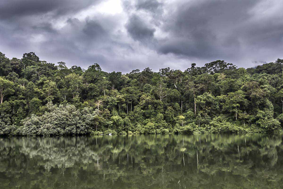
Much of the intact forest that remains is protected, at least nominally, in a series of National Parks, and, since 2004, as a UNESCO World Heritage Site known as the Tropical Rainforest Heritage of Sumatra (TRHS).
In recent years, concern has grown that Indonesian authorities are not doing enough to protect this critical biodiversity hotspot. Since 2011, the site has been inscribed on UNESCO’s List of World Heritage In Danger due to the risks of logging, encroachment, road expansion and poaching.
In 2016, UNESCO flagged up concerns about road construction in the area, particularly in Kerinci Seblat National Park, a protected area extending for 350 kilometers (217 miles) from northwest to southeast along the rugged spine of the Bukit Barisan Mountains.
In the years since, it’s been some good news and some bad news for Kerinci Seblat National Park.
In 2016, UNESCO identified 12 planned or proposed road projects in four zones of the park. Now, park officials say, the list of road expansion projects of concern has been whittled down to five. And of those, four are cancelled. The only project currently set to go forward is the improvement of an existing road, which runs from Sandaran Agung mountain across to Tapan near the West coast.
According to Hadinata Karyadi, a spokesman for Kerinci Seblat National Park in Sungai Penuh, the town encircled by the park, the local office of the forestry ministry had formally recommended to the minister that the four now-cancelled projects be denied approval. For example, Karyadi says his office urged the ministry to refuse approval for a proposed road through the village of Lempur because it threatened critical tiger habitat. Those rejections were duly issued over a two-year period, with the last project being denied a permit in 2018.
The road-improvement project that was approved presents fewer environmental concerns, Karyadi says, because it involves upgrading an already existing road rather than building a new one. The current road is steep, winding and currently in such bad condition that even public minibuses will not use it, Karyadi says. Once improved, though, he says the road will be sufficient to serve as an evacuation route in case of natural disasters — one of the frequent justifications for proposing new road projects in the park. “Improving the existing road is better than building a new one,” he says. “If it is good, it will be enough for evacuation needs for now.”
Some concerns do remain, because any increase in traffic on a road through the park could affect the local wildlife. In late 2018, Fauna & Flora International (FFI), an NGO working closely with the national park management, planned an “intensive biodiversity survey” to “assess impacts of upgrading a road running through the national park and make recommendations to government.”
For now, the most hazardous road proposals seem to be off the table, though FFI notes that “local political elites” continue to push for the revival of the cancelled projects. But the park and its ecosystems remain under serious threat due to population growth, agriculture and industry.
“Encroachment on the national park is the main problem,” Karyadi says. He adds that the current staff of around 70 rangers isn’t enough to police the huge perimeter and that his office has requested a larger budget.
One of the most controversial projects was the proposed new road in the south of the park, through Lempur. At present a trail runs from Lempur, through the village rice fields and continues as a wide rocky walking trail that winds through the forest. According to locals, it’s been there ever since anyone can remember. These days it’s used mainly to get to local tourist sites such as Kaco Lake and for trekking to the national park.
“My team made a full report and gave it to the ranger,” says trekking guide Andi Tiasanoawa in Lempur, explaining his response to the road proposal. “We don’t want people cutting the trees,” he says, adding that he makes his living from the forest and doesn’t want it damaged.
Guide Zacky Zaid, who has been trekking these hills regularly for 10 years, says a past road project in the area made people aware of the potential downsides such developments can bring. Zaid says that around five years ago the government agreed to build an access road to the village of Renah Kemumu inside the park boundary. “This route was one of the popular five-day treks that we did,” Zaid says. But once the road was built, the wildlife that the tourists came to see dwindled. “Lots of people cut the trees when the government built the road,” he says. “The nature is not really good anymore. There are no big trees anymore. For us I’m so sad. We closed trip there a couple of years ago.”
Ultimately, the Lempur road was rejected “because it threatened the tiger core area,” Karyadi says.
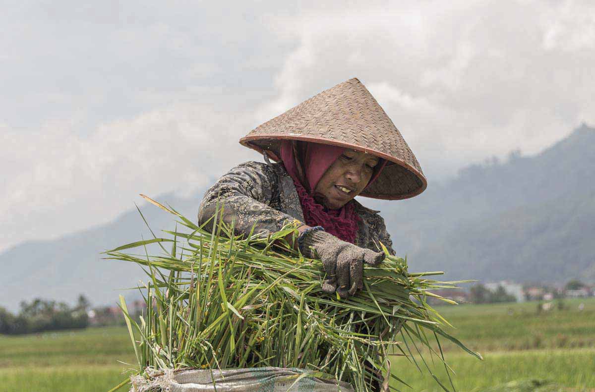
At 3,805 meters (12,483 feet) above sea level, Mount Kerinci is the tallest volcano in Indonesia, and dominates the landscape here. The alluvial sediment deposited by past eruptions provides the valley with mineral-rich soil that draws farmers. Steep hills that ring the valley create the boundary to the national park beyond. Migration into the valley has led to pressure on the park as farmers encroach on the hills.
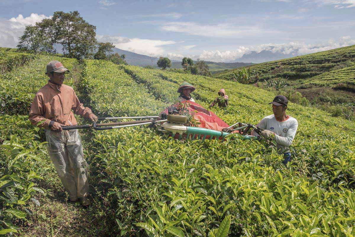
A huge 10,000-hectare (24,700-acre) tea plantation stretches across the valley floor; in between, farmer’s plots host a variety of everything from potatoes to tomatoes and coffee.
As the elevation rises and the valley floor gives way to the steep mountain slopes, the crops change to cinnamon, rubber, coffee and cloves. These tree crops give the slopes a forested appearance, but close up the hills are cultivated and densely populated with farming communities.
“The cinnamon boom is a particular problem” driving encroachment, says Karyadi. Others see it as a benign and sustainable traditional practice that also has economic benefits for poor farmers.
In the farming village of Talang Kemulun at the foot of the hills that form the valley’s southern perimeter, Eibru Hajar says he mainly grows cinnamon and coffee on his own land. “I have around a hundred cinnamon trees and cut them in a rotation cycle of 15 years,” he says. “I get around 50 kilos [110 pounds] per tree.
“The rangers come by every couple of months,” Hajar adds. “So I’m afraid of cutting the trees [inside the park boundary]. The penalty for cutting forest trees is a big fine and if you don’t have money you get several months in prison.”
But the threat of penalties doesn’t deter everybody, and NGOs like FFI report that land continues to be cleared within the borders of the park.
Illegal mining is another threat. In a 2018 report, FFI said it found alluvial gold mining sites in and around the park’s borders, “posing serious threat to a key tiger corridor with a dirt road constructed which entered the edge of the national park.” Despite the central government’s commitment to protecting the park, local political pressure on the park remains high. In 2017, it spilled into open conflict when gold miners held a municipal government official hostage, according to FFI.
FFI also tracks illegal logging and poaching of pangolins, tigers and other wildlife. It notes that law enforcement efforts since 2016 did seem to have an impact on reducing the poaching, but that these efforts remain a challenge.
With agribusiness and extractive industries hungry for new land, the pressure on Sumatra’s forests is relentless. Kerinci Seblat is no exception, and migrant farmers have swelled the local population, placing further pressure on the national park.
Last year the park management set up a Role Model Program, to try and stem escalating encroachment, especially by migrant farmers who frequently claim that the park’s boundaries are unclear.
“The park boundary is well demarcated with concrete markers about one meter [3 feet] tall,” Karyadi says. “In some places locals have dug up the marker posts.”
The scheme aims to restore encroached forest and establish alternative livelihoods. Along the way are manifold obstacles, not least gaining the participation and cooperation of sometimes reluctant farmers.
“This week we caught some illegal loggers and handed them to the police. They will be judged by the law,” Karyadi says. His office is trying to navigate a tricky path between encouraging farmers to change their practices through incentives (some get financial rewards under the Role Model scheme), and punishing offenders who have clearly broken national park rules.
For now, encroachment by farmers is ongoing, but local political attempts to accelerate this by opening up new areas through road-building have been limited. Meanwhile, political tensions remain between politicians seeking more infrastructure building and the forestry ministry, which works with the support of international NGOs to maintain the integrity of the national park and its borders.
First published by mongabay.com


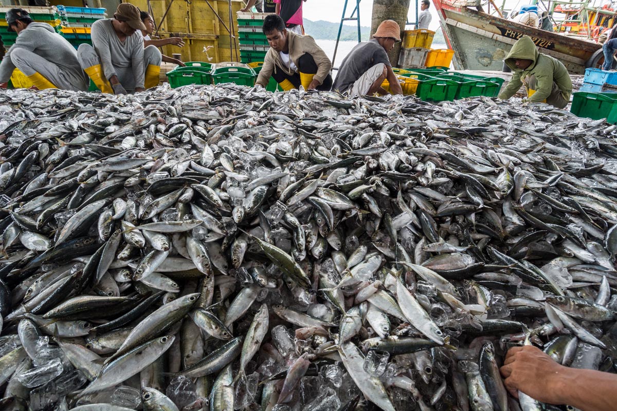
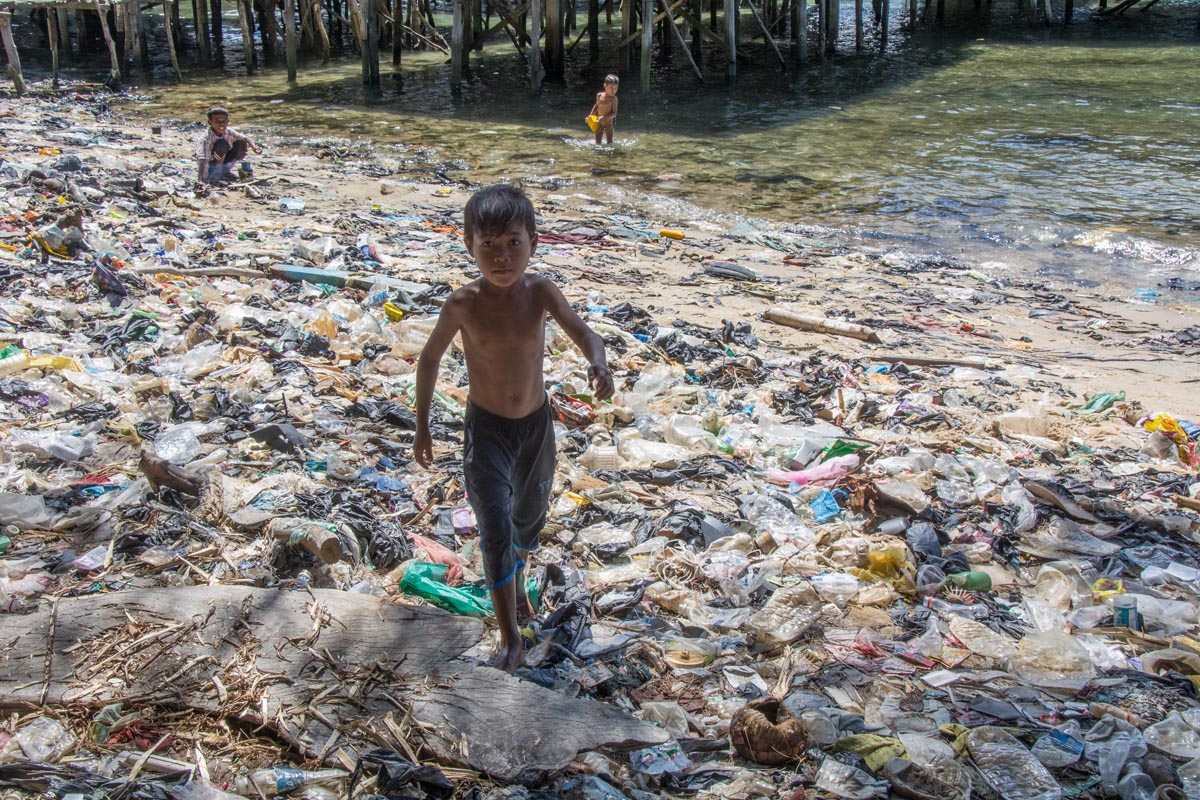
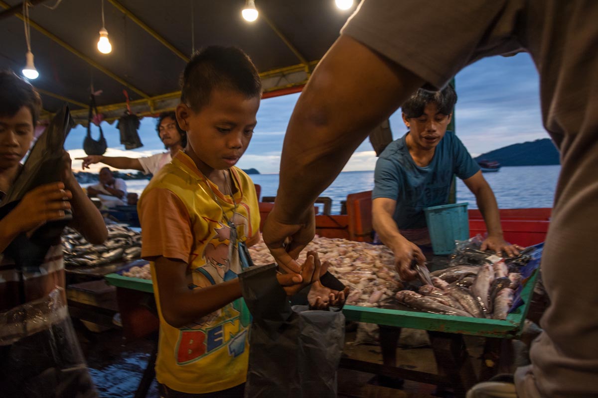
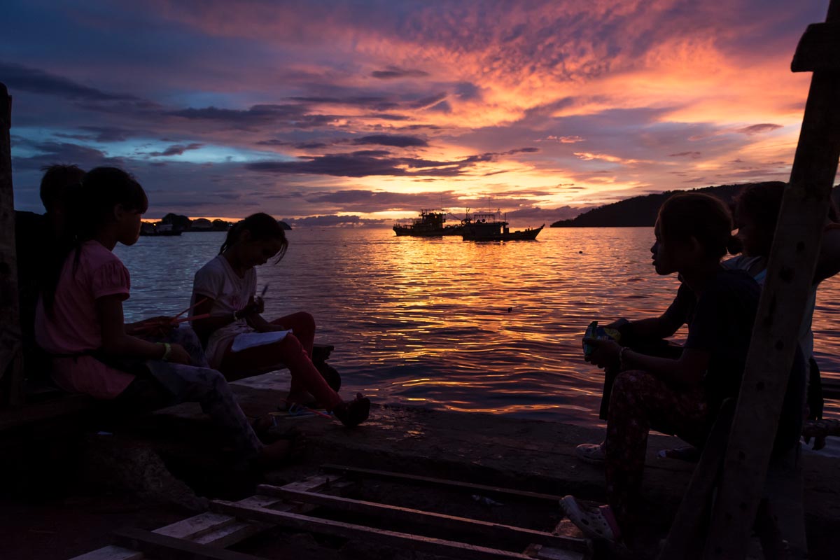
Lacking official recognition, children cannot attend state school and many end up with no education working in menial jobs. Others are exploited by traffickers. Many are Bajau sea-gypsies, others are immigrants from the Muslim Sulu area of Southern Philippines. Indonesian workers also come across the porous border from Kalimantan seeking work.
Many of the Bajau Laut sea gypsies have now settled in Sabah. Climate change, overfishing and poverty have caused them to give up their nomadic life on the sea in favour of the shanty towns of coastal Sabah. The presence of migrants has been tolerated because many are contributing work in the state. However in recent years a rise in Muslim terrorist activity at tourist resorts around the coast has made the government less tolerant towards the migrants and less inclined to provide residency papers. So these shanty communities remain in limbo, trapped in an insecure situation where they cannot progress.
This story follows children from the shanty villages of Gaya Island, offshore from capital Kota Kinabalu, as they fight, play and hustle for a living in the capital’s busy fish docks and markets.

Tens of thousands of undocumented immigrants live in Sabah, East Malaysia on Borneo Island. Some of them have lived there for many years with children born there. Not eligible for official documentation they are stateless people.
The first lesson we are taught in the Participatory Video training by NGO InsightShare taking place last October in Oxford, UK, is that mistakes are great! This is reassuring to many attending the week-long seminar, as making and screening a video to an audience can be, even for an experienced film-maker, a daunting task. Perhaps this approach is to put people unfamiliar with sophisticated technical equipment at ease.
We learn that for people in distant developing countries, often with little or no access to electricity, there are real challenges to overcome to get to grips with the Participatory Video process. Yet despite the challenges, among those involved in a growing global network of practitioners, there is a shared experience that participatory video, or ‘PV’ in short, generates remarkable results.
InsightShare is a key organisation at the forefront of pioneering and developing this methodology. PV first evolved in Canada in the late 1960s. Don Snowden was an early pioneer who developed the PV methodology at a small fishing community on Fogo Island in Newfoundland. InsightShare has been actively building the skills of communities worldwide since it began in the late nineties. Since then it has accrued a deep body of knowledge used to refine the effectiveness of its teaching.
The workshop curriculum is developed by drawing on years of accumulated hands-on experience in the field. Workshops are practically orientated with participants encouraged to learn by doing. At the end of the process the participants can showcase a tangible outcome of their efforts – their own video.
Although a simple concept at its core, implementing the PV process in the field can be fraught with difficulties. This is especially so as many of the communities with which InsightShare works are poor, often exploited and at the margins of society. Many have difficult issues to confront which can sometimes include tensions within the community itself or conflicts with powerful external actors such as corporations or governments.
Simply put, PV is a way of teaching people to make their own videos using video cameras and editing equipment. Used to support communities in developing countries, it has been gaining credence for some years as a way of providing them with a vehicle to identify and amplify their collective voice.
Many of those who have experienced the workshop-led process say they have found the experience empowering because it provides a way in which they can express themselves, their culture and opinions, without interference from outsiders who often promote their own agendas.
“They are open to it. So it’s another way of building community… that for them is really new, as a way of addressing their issues, their problems, their situations, or just showing what is beautiful within their territory. So I think they realise that this approach is different.” explained Thor Edmundo Morales. He has been an Associate with InsightShare since 2015, facilitating trainings in his native Mexico and more recently Liberia and Kenya in Africa.
The practical dimension of PV is to provide communities with the skills and equipment to produce their own videos about the lives of their community, their neighbours, relatives and each other. Then the process enables them to use these videos in ways that they find useful – however they decide that might be.
A typical film screening premiere will first entail showing the films to the community itself, so that everyone involved can identify with the results and share in the collective experience. Often this leads to discussion and self-reflection which can deepen understanding of important issues within the community.
“I think communities see themselves within the mirror which is the screen. Seeing themselves in the video, they start spotting new problems, issues, concerns or things they like, that they haven’t seen before.” explained Thor.
Many of InsightShare’s projects are with Indigenous People, often living in remote regions, and frequently with little access to services that we take for granted such as electricity. So it is something of a paradox that the PV methodology is quite heavily laden with high-tech equipment requiring an electricity power supply.
This issue throws up a bundle of technical and teaching issues which the PV methodology needs to overcome and address in order to be successfully adopted. People living in marginal circumstances are often dependent on subsistence livelihoods, making the most of the local environment to provide through forest foraging, agriculture, fishing or animal husbandry. Often participants will not have come into contact with modern equipment such as video cameras and computers in their day to day lives, and these will be unfamiliar to them.
The introductory process involves a series of exercises to help participants get acquainted with the concepts and equipment. Thor explained how he found workshop participants in Africa initially fearful of the technology, but this soon changed: “When they first saw the computer they were really afraid to use it and then after about two hours they were like, oh this is so easy,” he said.
“In Mexico many people we work with, particularly amongst the Yaqui, they had never touched a camera or computer before.” explained Thor. The Yaqui indigenous people live in the Sonora desert region in Northern Mexico. They have faced violence and intimidation as companies construct a gas pipeline across their territory, infringing their rights and threatening the fragile environment.
Anabela Jeka Carlon Flores, an indigenous Yaqui lawyer, is fighting the pipeline with her community of Loma De Bacun. In April 2016, Anabela’s community won a legal ruling requiring suspension of pipeline construction across Yaqui territory. However, the companies behind the pipeline: SEMPRA and INOVA, have ignored the court ruling and continued building.
Undeterred Anabela continued campaigning for justice, but in December 2016 she was kidnapped along with her husband and once released fled fearing for her life.
Anabela attended an InsightShare workshop with other members of her community in 2015 and soon came to appreciate the benefits: “The main benefits are that people are really thinking about their land, their culture, they are questioning. Before you cannot really see that they question big projects.” said Anabela, at a safe location some distance away from her home community, shortly after her kidnap ordeal. Soon she plans to overcome the threats she has received and return home.
Different communities around the world find PV useful for different reasons explains Thor: “The Yaqui use the cameras to record interviews, to show as proof to the Inter-American Commission on Human Rights, for the struggle they were having. They gathered a lot of interviews and sent them as evidence to sustain their case,” he said.
While InsightShare refrains from getting directly involved in community struggles, it does equip communities with the tools and skills to be able to put forward their perspectives and opinions, sometimes to policy-makers or companies that are disrupting their lives. This is in keeping with the now widely established view that effective development must recognise power relationships and equip people with the skills to be able to participate in the discussions and decision-making processes that effect them.
The Maasai people of Kenya and Tanzania in East Africa are nomadic pastoralists who regularly move with their herds of goats and cattle. After independence it was agreed that the Maasai would move from their lands to allow the creation of the Serengeti game reserve. They were given new lands in the Ngorongoro region, which is now hotly contested by different stakeholder’s including the government, conservationists, investors, the tourism industry and the Maasai people themselves.
The Maasai say that in recent years their community rights to use the land have been increasingly eroded and ignored. Along with big game animals The Maasai became a familiar part of the safari tour, regularly appearing in safari promotional literature and media coverage.
“The image and the name of the Maasai is used to sell everything from the safari tour to I don’t know – hand soap. Just everything. It is a very heavily exploited image. One that is not in the control of the Maasai people themselves.” said InsightShare facilitator Gareth Benest, who has held PV workshops with the Maasai.
“Everyone was distressed and emotional. We discussed how the Maasai brand is worth an estimate US$10 million annually but the community gains no benefit. This was one of the most difficult sessions I have ever had with the group.” said Gareth.
It is not only ongoing voyeurism of the Maasai and exploitation of their image. Since colonial times a romanticized view of their lives has been constructed by outsiders projecting their own view of the Maasai upon them, which may be completely inaccurate. It may also gloss over pressing issues.
Gareth explained how at their first workshop the Maasai participants were excited to be able to tell their own story: “They said that we’ve had journalists come and go. We’ve had film crews, we’ve had photographers come and go, and we’ve seen how other people tell our story, and now it’s time for us to tell our own story.”
“PV is a particularly interesting and exciting tool in enabling a community that has never benefited from being able to represent themselves in the world, to start to take control of their own image, albeit in a small way to begin with.” Gareth explained.
Sometimes the burning issues for a community have less to do with pressures from outside and more to do with contested issues within the community itself such as changing attitudes towards cultural traditions. Alternatively, it is common for powerful actors seeking to exploit communities, to use divide and rule tactics (such as bribes, intimidation and offers of work), to create conflict within communities, so weakening their opposition.
“I was given an award, a distinguished human right defender” said Samwel Nangiria of NGO-Net in April 2017. He was awarded the Rural Human Rights Defender of the Year by NGO the Tanzania Human Rights Coalition. “Human rights have no borders and its protection calls for global community. It was really emotional. The Olosho video was screened to show the voices of the people… I mean I had to shed tears of hope and happiness. There will be a big community reception party in Loliondo… It’s a victory for the entire community.” said Samwel.
Samwel is from Loliondo in the Tanzanian state of Arusha and has been involved in PV since the first workshop was held in 2015. He said that PV has improved, “Unity among communities, and in particular the clans within Loliondo.” He said, “the video has restored trust” and bridged the breakdown in communication between segments of the community and clans, “that was rampant before.” Samwel explained.
“Three of them have had over a year of arrests, of beatings, Samwel was tortured.” Gareth said, explaining that the impact of the video has caused the government to review its approach. “Previously the government thought, well all we have to do is silence the troublemakers, get rid of these individuals and we’ll be able to implement our own plans for the land. When the video came out there was a realisation that even if they do silence those people, they can’t stop the community’s voice from being heard. The government changed its whole approach because of this. It no longer saw force as an option.” Gareth explained.
Samwel relayed how his community found the PV process provided a way to amplify their concerns and ensured that they were heard, even in political decision-making circles: “The Olosho video was taken by many politicians at the last general elections (in 2015) as a starting point for our community based land rights campaign.”
“Recently, the video was re-screened before the government mission that was in the district trying to strike a balance between wildlife and people in the Loliondo Areas. The mission was seeking for the community position with regards to wildlife conservation and investment in the village lands.” said Samwel.
A finished video product is usually, though not always, a significant outcome of the PV process. However, Gareth is keen to stress that their model of PV is not driven by video outputs. Sometimes there are situations in which members of the group consider that releasing their film could attract adverse attention, exacerbate community divisions or provoke repression from external forces.
The most important result of the experience is not necessarily the final video, but more the learning and experiences shared by community members as they go through the production process.
Assessing the precise impact of the PV process is arguably impossible as it is not just about counting the number of finished videos produced. However the growing body of monitoring and evaluation learning that InsightShare has gathered, demonstrates the effectiveness of the methodology, and this has proved attractive to donors, ever keen to show that their money has real and tangible outcomes.
Once the workshop is finished and it is time for InsightShare’s facilitators to move on, the question arises as to what happens in future. InsightShare is always keen to leave behind the hardware (camera, sound equipment and laptop) to enable communities to continue making videos in their own time and for their own needs.
Samwel explained that PV has had a “high multiplying effect.” and he is working to train others in the community to pass on the skills: “We would like to advance the capacity-building of the group (‘Oltoilo-le-Maa’, meaning ‘Voice of the Maasai’) to establish a simple and functioning community media hub.” he said.
“The videos we created in Mexico, I took them to Kenya and Liberia and we showed them.” Said Thor, explaining the benefits of sharing and reflecting on PV work, no matter where in the world it has been produced. Thor explains the wider strategy being pursued for networking groups together: “InsightShare is trying to make a network where people trained by InsightShare actually meet each other…Put people together so they can interact.” he said. This network of regional hubs is now taking shape to share experiences of PV worldwide.
As the workshop wraps up in Oxford the group forms a circle and reflects on the six day training. Everyone shares how the intensive learning experience has both touched and challenged them in different ways. On one thing everyone agrees – the PV process involves much more than simply making a video.
 La Marabunta Filmadora began life as community video project bringing Comcaac and Yaqui participants together for the first time in 2010. Now they make participatory videos with Guarijios, Mayos, Pimas, and Raramuri indigenous groups, reaching right across northern Mexico. Credit: Thor Morales/InsightShare.
Learn more about PV on the InsightShare website.
By Rod Harbinson


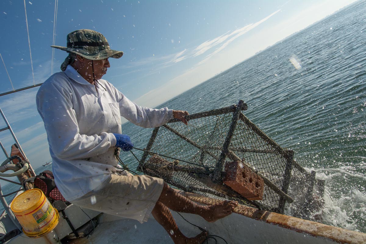
Using a method called triangulation, his keen eyes pinpointed natural markers on the shoreline and used these bearings to locate his traps with incredible accuracy. With an anchor thrown down, he snagged his trap and hauled it up. The deck was soon awash with flapping fish. These are grouper — prized in the restaurants of Penang and beyond, they fetch a premium price and can only be caught with hooks or traps, Liew explained. He said customers travel from as far as Hong Kong to buy these prized delicacies.
“Look at this mud in the traps,” Liew complained as just two of his four traps contained a catch worth keeping. Still, it was a good day under the circumstances. One phone call later and the 11 kilograms (24 pounds) of grouper were snapped up by a restaurant owner eager to purchase them for over 500 ringgit ($113). They were still alive when Liew delivered and weighed them while hungry customers looked on.
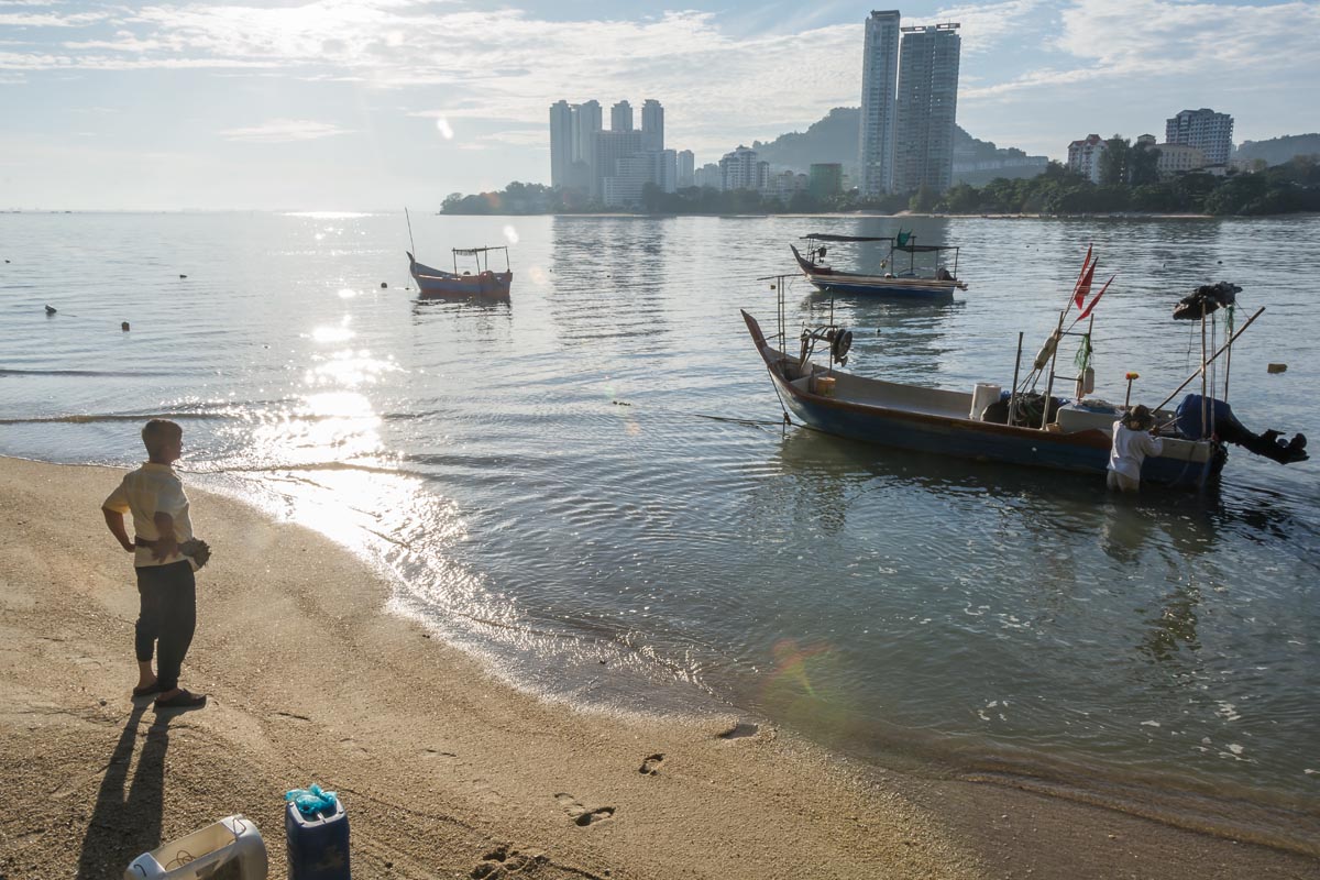
“I know this area very well because in my school days I followed one of the fishermen,” said Liew, from Tanjung Bungah a village North of Penang Island’s capital Georgetown. Now the days of his fishing grounds are numbered because of a land reclamation project by a local property developer.
“This area is very rich with mud crab, shrimp, snapper, and grouper, but soon it will all be gone,” said Liew.
The island of Penang, which lies off the west coast of peninsular Malaysia, is famed for the British colonial era architecture that won its capital, Georgetown, an inscription on the UNESCO World Heritage list. These days, though, soaring land prices mean most of the development is high-rise. Housing 2,372 people per square mile as of 2010, the island is the most densely populated place in Malaysia. With demand for real-estate high and land scarce, developers have ambitious plans to build out into the ocean by reclaiming coastal land and building islands made of sand — a drive supported by the Penang State government.
Reclamation projects have already been completed next to the second Penang bridge, which stretches 24 kilometers (15 miles) to the mainland from the island’s Southeast coast. Another reclamation scheme, known as the Seri Tanjung Pinang Project has also launched. Stage one, referred to as STP1, was completed in 2006: the 97-hectare (240-acre) extension to the shoreline northwest of Georgetown is filled with luxury housing and an upscale mall. The project’s second phase (STP2), which involves the construction of a new island as well as additional coastal reclamation, is currently underway. When STP2 is complete, it will bring the project’s total amount of reclaimed land up to 404 hectares (1,000 acres) of condominiums, shopping malls and leisure facilities. The project will also reclaim a 131-acre coastal strip for a government park.
Plans are also afoot for an even bigger reclamation project on the South of the island at Permatang Damar Laut.
All of these plans have been contested by environmentalists concerned about the impacts on dwindling mangroves, fisheries and birdlife – not only at the construction sites themselves, but also at the mine sites supplying vast amounts of rock and sand.
As Liew and I motored back to shore, we were escorted by a security launch. Guards on board shouted a warning for us to leave the construction area. On our port side, a rock bund wall was being filled in with sand by diggers, indicating the edge of the new reclamation island. On our starboard, out to sea, tug-boats, pontoons, dredge-ships and sand transport barges filled the sea with heavy construction traffic.
“That is Rat Island” said Liew, pointing to an outcrop of boulders and mangroves that houses a cemetery. A pair of white-bellied sea eagles (Haliaeetus leucogaster) took off from the rocks as we approached, one carrying a fish in its talons. According to the Environmental Impact Assessment (EIA) for the second phase of Seri Tanjung Pinang, these eagles are one of ten bird species that are “Totally protected” under Malaysia’s 2010 Protection of Wildlife Act, among a total of 73 bird species found to be inhabiting the project area.
“Those are the only mangroves left,” said Liew pointing to a few isolated trees. Because they provide essential habitat as fish spawning grounds, Liew is especially concerned about their loss, explaining that mangroves used to line the coast all the way to Georgetown six kilometers away. These will disappear with the planned coastal expansion under STP2.
“We have another 760 acres to go,” said Jonathan Yeoh, manager of group corporate strategy with Eastern and Oriental, the development company whose colonial-era flagship hotel graces the waterfront of Georgetown. It will retain its waterfront view, said Yeoh, but many other buildings will overlook the new island, known as STP2, to be connected by two bridges. E&O subsidiary Tanjung Pinang Development is coordinating construction of the project.
Mageswari Sangaralingam, a research officer for Friends of the Earth Malaysia in Penang questioned whether this style of development is appropriate for Penang: “There is almost like a glut of residential condos with many lying empty. What we need is low cost: medium-low cost housing projects which are affordable for the people. But then they are building these luxury condominiums which are not affordable. Most are vacant because they are owned by foreigners.”
Yeoh said his company could not comment on the master plan, which remains confidential. However, he was keen to stress that the island developers will set aside “30 percent” to cater for low-cost local housing.
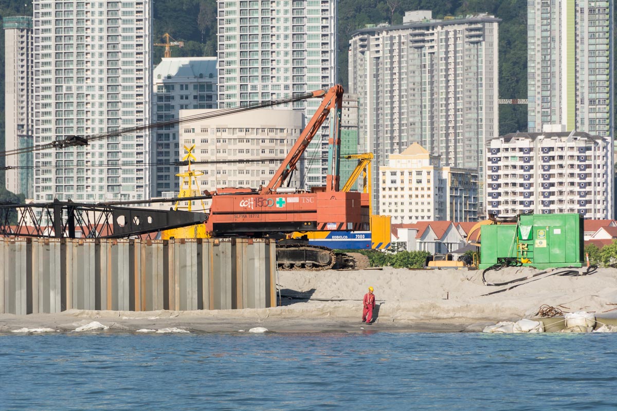
A Chinese contractor, China Communications Construction Company Ltd is undertaking the works, via its wholly owned Malaysian subsidiary. The company, which claims to be the “world’s largest dredging company,” has considerable experience. As well as working on the 24-kilometer long Penang bridge, it was also involved in construction projects at the Hong Kong and Macao airports. A representative told Mongabay that while it was overseeing the works, it also employed local workers.
The reclamation works entail removing existing mud from the seabed. This dredge waste is dumped at a designated site about 40 kilometers to the North of Penang Island. Two million tons of rock plus steel piles will create the outline perimeter of the island. This is being filled with 33.1 million cubic meters of sand to eventually create the island and raise the level high enough above the water level to weather high tides and storms. The EIA says that shipping this quantity of sand will be done by 10,000 cubic meter barges requiring 3,820 trips over five years, each one of 171 kilometers.
The sand is being shipped from the Malaysian state of Perak, where it is being dredged from the seabed about 40 kilometers offshore. The Perak state government expressed alarm at the plans on March 12, citing potential environmental implications for its pristine islands such as Pangkor and the Sembilan cluster of nine islands. Perak First Minister Zambry Abd Kadir told the New Straits Times the state government “was in the dark over the matter.” Although the central government makes decisions concerning matters in coastal waters over three miles offshore, the minister complained that the State government should have been informed.
Questions remain about whether the authorization to mine sand in the area has been renewed. “The EIA was approved in 17 Sept., 2007. We got a response from the Department of Environment Perak. They said approval has lapsed and that if they want to carry out the mining activity they will have to submit a new EIA. We will write to the Government again to see if it was submitted or not,” said Friends of the Earth’s Sangaralingam.
Another development on the drawing board is the Penang Southern Reclamation (PSR) project, which is being developed by the Penang State government as a way to raise funds for an ambitious transport infrastructure program. The project would see three reclaimed islands, covering a total of 1,659 hectares, being constructed off the coast at Permatang Damar Laut.
This project, set to begin in 2018, has yet to receive final approval. Natural Resources and Environment Minister Wan Junaidi Tuanku Jaafar on Dec. 28, 2016 requested that all reclamation projects in Penang be put on hold. He cited concerns about the extent of the projects. He also said that it would be preferable to follow new national environmental survey methods for Environmental Impact Assessments, currently being finalized.
With reclamation projects to north, east and proposed in the south, expert assessments indicate that the entire physical structure of the island could be affected, explained Sangaralingam. “The whole geomorphology of the island will change. The flow of the currents will also change. There will be impacts to fisheries,” she said.
Fisherman Mohd-Ishak Bin Abdul Rahman was among a thousand fishers who took to the sea on January 13 to protest the effects of land reclamation projects on their livelihoods. “We are not asking for compensation,” said Mohd-Ishak who is Chairman of the Northern Fishing Community Group of Tanjung Tokong where the flotilla of around 450 fishing boats displaying protest banners set sail. “We are asking the company [Eastern and Oriental company] to pay 200,000 ringgit for new fishing equipment to enable us to continue fishing,” he said.
The decline in fish stocks has hit fishers’ incomes, and all complained they now catch fewer fish than before the reclamation began. Mohd-Ishak says that where they can no longer fill demand, buyers are looking to Thai fishers eager to oblige.
“The last six months our catch really dropped very much,” said Mohd-Ishak “Before, let’s say last year, we could catch around 100-200 ringgit. Now we go out and we are lucky to catch 40-50 ringgit.”
Inshore fishers from the community say that their fishing grounds were a short distance away until the project started. Now they have to motor much further out to sea, crossing a treacherously busy shipping lane in the process.
Unprotected by the shore, the fishers encounter higher waves that can only be navigated with bigger boats and more powerful engines, Mohd-Ishak explained. Deeper waters require deeper, heavier nets — all of which require considerable investments for which bank loans are not easily available. “Now we must go further out and use a big engine and a big winch. We need a winch to pull the nets. We cannot pull by hand. We are asking for these things but up to now they never give any answer,” said Mohd-Ishak.
Last year, Malaysia’s Fisheries Development Authority (LKIM) gave each licensed fisher 15,000 ringgit. “It was not compensation, we call it consolation,” said Mohd-Ishak echoing widespread discontent over the payment amount.
“There was no agreement, no nothing attached to the 15,000. Now we fight. We say we never asked for 15,000. We don’t know who accepted this figure.” he said.
When Mongabay questioned E&O’s Yeoh about the fishers’ grievance he said, “I think we have to be very up front and very frank that there will be a loss of marine life.”
“The Ex-gratia payment is determined by the LKIM, which is the fishery department and also the fishery commission as well, so we work very closely with them, and also seek their direction in terms of this ex-gratia payment,” Yeoh explained. Fishers need to bring their grievances to the LKIM who set the payments, he said. “We pay whatever they identify.”
Asked if E&O would be ready to pay more to resolve the situation Yeoh said: “We would have to go back to the drawing board and discuss what is reasonable.”
“The fishers are not happy with the consultation,” Mohd-Ishak said, arguing that fishers have been ignored and agreements made at the original consultation have not been honored: “It was agreed that there would be a discussion and agreement between the fishers, the developers and the government, but the developer and the state did not discuss with us about how to deal with these things, but came up with this sum of 15,000 ringgit given to us.”
Mohd-Ishak says he has, “Written letters to all the agencies at the state and federal levels but there is no answer. No nothing. I also wrote to the LKIM, the federal body.” Mongabay contacted the LKIM about Mohd-Ishak’s complaint but did not receive a response.
The coastline has already been transformed beyond all recognition from the first reclamation project. Now, the beach where the fishing community of Tanjung Tokong lives and keeps its boats is the last natural stretch of beach remaining in the area. Mohd-Ishak lives in a basic compound in a rudimentary brick bungalow that he built himself behind the beach, which is now surrounded by luxury high-rise condominiums towering over the beach community.
One of the main complaints fishers have is that the building works have led to a decline in fish stocks, which they mainly attribute to increased turbidity due to the reclamation dredging.
Kamaruddin, 70, is fixing his net. He points to a large net cage explaining, “Until five years ago I put that in the sea to keep my live crabs in, but then they started dying from the silt if I left them inside overnight.” He showed Mongabay two concrete tanks he now uses instead.
“Hopefully Penang will become the new Singapore,” said taxi driver Loh Hock Seng, who is excited about all the development taking place. As fisher Mohd-Ishak points out, Singapore no longer has a domestic inshore fishing fleet, relying instead on aquaculture and imports from neighbors such as Malaysia.
Published on Mongabay.com


The Sambor Dam is one of Cambodia’s priority energy projects, according to the country’s “Master plan for the development of energy generation.” This plan was a well-kept secret until two pages from it appeared Feb. 17 in a snapshot posted on the Facebook page of Phay Siphan, a government spokesman.
The plan posted by Siphan states the Sambor Dam will be completed in three stages from 2025-2027, with a total power output of 1,800 megawatts. Attempts by Mongabay to get government comments on the plan were not answered and few details are yet known about the proposed scheme.
The dam, in Kratie province, is the biggest of Cambodia’s two proposed mainstream Mekong dams. It has been on the drawing board for over a decade, but final plans do not yet appear to be in place. Last month, the Cambodia Daily reported that in October 2016 the cabinet greenlighted feasibility studies for the Sambor and two other proposed dams, but as yet there has been no confirmation that the Ministry of Mines and Energy has signed on.
It’s unclear who will undertake construction work, but Cambodian business tycoon Kith Meng, chairman of The Royal Group, was in February announced as the Cambodian partner. According to rights group Global Witness, Meng is, “known for involvement in land grabbing and illegal logging.” Global Witness also found that the Prime Minister’s daughter, Hun Mana “is a director and shareholder in Royal Group Investment Company.”
Back in 2008, dam builder China Southern Power Grid released the original feasibility study for the Sambor Dam. It put forward three different dam options with differing locations, electricity outputs and reservoir sizes. The favored option, they said, “would have an installed capacity of 2,600 MW, and a dam over 18 km long and 56 m high.” China Southern Power Grid’s original cost estimate for project exceeded US$5 billion.
Along with the inundation of the riverbank, four inhabited islands in the mainstream would be submerged. This would force the relocation of over 19,000 people making it by far the greatest displacement of people of any Cambodian dam – either constructed or planned.
In 2011, China Southern Power Grid withdrew from the project after protests from villagers who feared their fisheries would be destroyed. “CSG is a responsible company,” a spokesman told reporters.
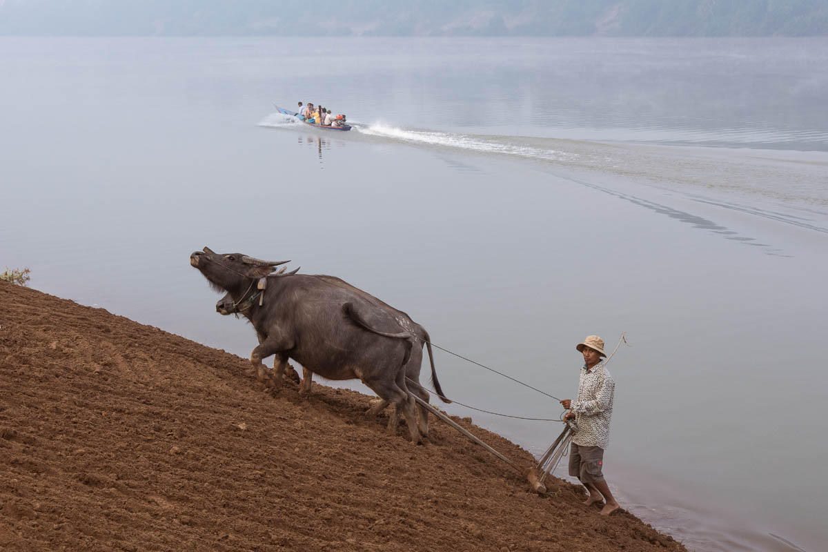
Suong, a commune head on Tnaot Island, fled the Khmer Rouge genocide to the island in 1979 to seek protection from the invading Vietnamese forces. His commune had made a collective decision to flee and found the island, one of four in the river, uninhabited.
Now 64, Suong said it was tough work clearing the dense tropical forest to barter wood for rice, and that in the early days many contracted malaria. He recounted tales of the extraordinarily rich biodiversity, with tiger and deer sightings on the island and the clear, flowing river teeming with fish.
They fished for crocodile catfish (Bagarius suchus) with their bare hands, pulling them out of the water, he recalled. Not the only ones to plunder this bounty, they shared the river with Irrawaddy dolphin (Orcaella brevirostris) and Siamese crocodiles (Crocodylus siamensis).
Suong told folk-tales laden with animist superstition which highlighted the reverence, fear and respect that people then had for the natural world. He also described how people still revere the dolphin, regarding it as a lucky omen.
Now multiple pressures from population growth, modern technology and pollution are placing strains on the local ecosystem.
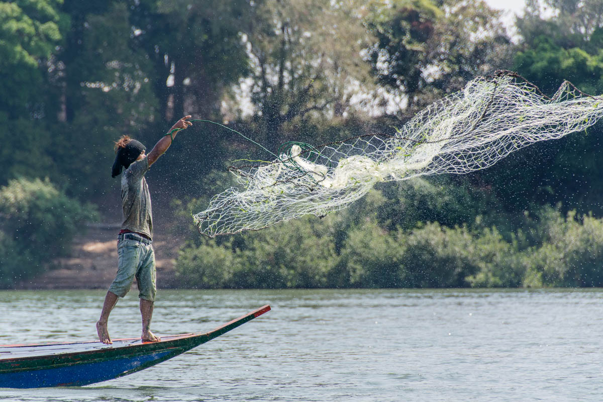
Fishers like Nous Sokaum said their catches have plummeted over the past three years. Sokaum said his typical daily catch used to be 100-200 kilograms per day. “Now I am lucky to catch five kilograms in two or three hours,” he said. Although their explanations differed there were common themes, especially illegal fishing and, in particular, the use high-voltage electrodes to stun and kill fish.
Villagers speculated that the decline in fish stocks could also be due to the impacts of dams already constructed upstream in Laos and China, which appear to be affecting the river. Kaeng Khin of Kampong Rote village on Rongeav island explained that, “everyone expected water levels to rise in the rainy season, but not in the dry season,” as she had experienced several times.
Experts are in agreement that a much bigger threat is on the horizon if the Sambor Dam goes ahead. According to a 2015 study by WorldFish and CGIAR, the Mekong is home to 781 fish species, making it one of the world’s most biodiverse rivers and an essential source of food security for the river basin. It also found that many of the river’s 165 migratory fish species would be impacted by the dams, causing fish yields to collapse.
According to the Cambodian Fisheries Administration, the Sambor Dam alone is predicted to reduce yields of fish and other aquatic animals by 16 percent to 30 percent.
The proposed dam site is also home to nine of around 90 Irrawaddy dolphins still estimated by WWF to live in the Mekong. These dolphins are already threatened by illegal fishing equipment like gill nets, said WWF Country Director Chhith Sam Ath. “Last year six dolphins died, but this was a reduction compared with 2015 when there were nine deaths,” he said. If the dam is built, Sam Ath thinks it is unlikely the remaining dolphins would survive.
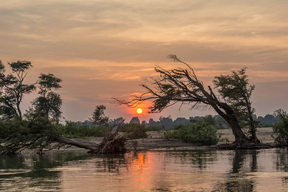
Changes to the river’s ecology won’t just affect local aquatic life. The Mekong provides nutrients for fish all the way down the river and even feeds sea fish as the sediment plumes beyond the Vietnamese delta.
Plau Saret, 44, described how during the rainy season the river rises, flooding large parts of Tnaot island. “My rice fields get flooded,” she said. The silt deposited on her fields renewed the nutrients and led to a better rice crop, she explained, while her husband, Leurn Sittar, was tilling his vegetable gardens on the banks of the river both to make use of the rich alluvial sediment left behind in the soil. These precious sediment deposits are stopped by dams, instead settling in dam reservoirs.
Nous Sokaum, 66, is a member of the village council on the Island of Koh Real. Around ten years ago, he said, Chinese surveyors placed a concrete marker near his house to mark the dam site. Despite the apparent threat to his property, he remains positive about development in general. He said he agreed with fellow party members from the governing CPP who told him the dam “would be a good thing because it would provide a bridge across the river.”
Forest campaigners find this bridge a worrying prospect. On the west side of the river is the Prey Long forest, the most biologically important lowland forest remaining in Cambodia. According to forestry consultant Marcus Hardtke, previous dam projects unleashed a stampede of government-sanctioned logging to clear reservoir sites and usually this extended far beyond the reservoir boundary.
In 2013, the Cambodian Government hired the San Francisco-based Natural Heritage Institute (NHI) to review hydropower generation options for the Sambor project. “NHI has assessed 10 alternative sites, designs, scales and operations including the originally proposed 2600 MW,” the institute’s CEO Gregory Thomas said by email. “[Five] ministries and many departments of the [Royal Cambodian Government] were briefed on the results of the assessment in December. The narrative report is forthcoming,” Thomas added.
“We heard of them [NHI], but they haven’t contacted us yet,” said WWF’s Chhith Sam Ath. He questions the assessment’s legitimacy: “If NHI is not going to do a consultation, in a participatory manner with stakeholders, then it’s wrong. It’s not actually representing the voice of people, or civil society, or community people in this area.”
With feasibility studies routinely withheld by the Government, civil society is keen that the NHI assessment is shared publically. However, Thomas explained that for now, “we are honoring the request of the RGC [Royal Cambodian Government] to limit distribution of the results of this assessment.”
According to Thomas, “The reticence of the RGC officials is based on their fear that critiques from the NGOs will be neither technically competent nor constructive. Is that well-founded? We have already seen some of them propagating uninformed speculation in lieu of facts.”
Founding Director of Mother Nature Cambodia Alejandro Gonzalez-Davidson criticized the NHI for its involvement in the Sambor project at a time when the Ministry of Mines and Energy is being questioned regarding a multi-million dollar corruption scandal, and governments and NGOs give the country poor marks for corruption.
“I find it extremely alarming that an organization that is funded by taxpayers money from the US is shaking hands with the Ministry of Mines and Energy,” Gonzalez-Davidson said. “This should not be a conversation about energy and electricity generation, it should be a conversation about how not to allow these gangsters [in the government] to go ahead with this new scheme – and destroy one of Cambodia’s most vital assets, the Mekong River.”
He is concerned that by engaging with the Government the NHI is lending legitimacy to the project. “This is something that the MME really wants. It’s all about green-washing their project,” he said.
Meanwhile, lack of information is a common complaint from villagers on islands that would be submerged if the original dam site is chosen. Most people had heard of the dam, often through NGO activities, but they were less certain about what the impacts would be: whether their land would be submerged, or even whether they would have to move out the way. If so, they did not know where they would have to go and whether they would receive compensation.
“There are four communes on Koh Tnaot island but only this one seems to care about the dam,” said Dung Sofu Eun, headman of Kampong Rote said. “I went to talk to other communes but the authorities were not really open. Even in commune meetings they don’t speak about the dam. I’m very concerned that we don’t have enough information.”
On Rongeav Island, Kaeng Khin said that when she ventured to a gathering in Phnom Penh to advocate for sustainable energy, her sister got a visit from eight policemen asking what Khin was up to. Khin said that her sister felt intimidated so paid them a considerable bribe to go away and leave her family alone — money that Khin repaid and for which she says she is now in debt. Khin reported the incident to human rights groups, but Mongabay was not able to independently verify her claim.
Gonzalez-Davidson — who in 2015 was deported for campaigning against the Areng dam – regards intimidation tactics as a familiar state ploy to push through infrastructure schemes: “Every single relevant state agency will lobby on behalf of the dam and most shockingly, they will try to stymie all efforts by activists, communities, and NGOs who are trying to stop the dam.”
NGOs believe that some of the options being explored by NHI include dams which only partially block the river to supposedly allow sediment flow and migration. But Maureen Harris, Southeast Asia Program Director at International Rivers had misgivings: “We are not aware of evidence that these serious impacts can be effectively mitigated and these concerns have been expressed again and again including in the MRCs strategic assessment.”
The weight of evidence against the dam has led NHI to look into other alternatives. Thomas from NHI confirmed that a floating solar array on the Lower Sesan 2 reservoir is being explored as one of the “no dam” options that are part of their comparative assessment, which “will be completed by the end of 2017,” Thomas said. Floating array technology has attracted attention as a way of increasing reservoir efficiency because the floating solar panels deflect heat, so reducing evaporation.
“We have measured our land and registered it with the commune head,” said Plau Sareth. She explained that it might help to prove the extent of their land if they ever need to claim compensation. She plans to complain about the dam. “I am not sure if we will win and people don’t have a lot of knowledge or confidence that they will win against the government,” she said, but many of the Mekong islanders who Mongabay spoke to said that they are against the dam and will try to stop it.
First published on Mongabay.com


